Geography of Panama
Explore Panama's isthmus geography, diverse landscapes, and strategic canal location.
Understanding Panama’s Unique Position
The Isthmus: Bridge of the Americas
Panama occupies a narrow strip of land, an isthmus, that serves as the physical connection between North and South America.
This unique position has long made it a strategic crossroads for global trade, but it is also a vital corridor for biodiversity, where flora and fauna from two continents meet and mingle, creating a palpable sense of being at the center of the Americas.
The “S” Shape and Its Impact on Travel
Unlike most Central American countries, Panama lies on an east-west axis, forming a distinct “S” shape.
This orientation leads to some geographic curiosities. For instance, from certain points in Panama City, you can watch the sun rise over the Pacific Ocean and later set over the Atlantic (Caribbean Sea) side, a counterintuitive experience for many visitors.
This shape also influences travel logistics. A journey that appears short “as the crow flies” may require a more circuitous route along the country’s length. We encourage you to consult a map, which is included in your travel documents, to better visualize how this orientation affects travel times between destinations like Panama City and Bocas del Toro.
Major Geographic Features
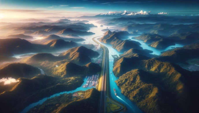
The Panama Canal: A Man-Made Marvel
The famed Panama Canal cuts directly across the narrowest point of the isthmus, a monumental feat of engineering nestled within a lush, tropical landscape.
Its primary function is to connect the Atlantic and Pacific Oceans, creating a vital shortcut for international maritime shipping.
A key component of the Canal is Gatun Lake, a vast artificial freshwater lake that was, at the time of its creation, the largest in the world. Today, it is not only essential for the Canal’s operation but also a remarkable destination for observing wildlife in its natural habitat.
The Continental Divide: Mountains and Volcanoes
A spine of mountains, known as the Cordillera Central, runs down the center of Panama, forming the continental divide.
The highest point in the country is Volcán Barú, a dormant volcano located in the western province of Chiriquí. On a clear day, its summit offers panoramic views of both the Pacific and Caribbean coasts.
This mountainous divide is crucial for understanding Panama’s weather. It separates the Caribbean and Pacific watersheds, resulting in distinct microclimates and ecosystems. The Caribbean side generally receives more rainfall, fostering dense rainforests, while the Pacific side often experiences more defined wet and dry seasons.
Two Coastlines: Caribbean vs. Pacific
Caribbean Coast
Panama’s Caribbean coast is defined by its clusters of islands and archipelagos, such as Bocas del Toro and the San Blas Islands. The waters are typically calmer, and the landscape is one of dense tropical rainforests extending directly to the sea’s edge.
This side is renowned for its vibrant coral reefs, making it ideal for snorkeling and diving, and is home to significant indigenous territories, most notably the Guna Yala.
Pacific Coast
The Pacific coast is significantly longer and more varied. It is characterized by dramatic tidal variations, powerful ocean swells that create world-class surfing conditions, and a greater degree of commercial and residential development.
Notable destinations here include the Pearl Islands, the expansive Azuero Peninsula, and the protected marine park in the Gulf of Chiriquí.
A Traveler’s Guide to Panama’s Regions
The Canal Zone and Panama City
This central corridor is a unique blend of modern urbanism and protected nature. The metropolitan hub of Panama City sits at the Pacific entrance to the Canal, while the Canal itself is flanked by lowland rainforests, such as those found in Soberanía National Park. This remarkable proximity means you can be in a bustling city one moment and exploring a rich, accessible jungle the next.
The Western Highlands: Chiriquí
The province of Chiriquí is defined by its mountainous terrain, high-altitude cloud forests, cooler temperatures, and exceptionally fertile volcanic soil.
This geography makes it the heart of Panama’s agriculture and eco-adventure. The rich soil supports renowned coffee plantations, the rugged landscape is perfect for hiking trails up Volcán Barú, and the unique cloud forest environment in towns like Boquete and Cerro Punta offers some of the world’s best birdwatching opportunities.
The Caribbean Archipelagos: Bocas del Toro & San Blas (Guna Yala)
This region is composed of hundreds of islands, cays, and islets scattered across the turquoise Caribbean Sea.
While both are island chains, they offer different experiences. Bocas del Toro is more developed for tourism, with lush rainforest-covered islands, a lively town, and a variety of accommodations. The San Blas Islands (Guna Yala), an autonomous indigenous territory, offer a more rustic and culturally immersive experience, with simple accommodations on small, palm-covered sand islands managed by the Guna people.
The Azuero Peninsula: The “Dry Arc”
Projecting into the Pacific, the Azuero Peninsula is known for being part of Panama’s “Arco Seco” or “Dry Arc,” a region that receives significantly less