10 reasons why I switched from DJI Fly App to Litchi App
Discover the top 10 reasons that led me to ditch the DJI Fly App in favor of the advanced Litchi App.
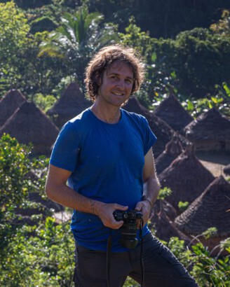
As a drone pilot, you've likely experienced the intuitive ease of the DJI Fly app. It’s the gateway to effortless aerial photography and videography. But what happens when your creative vision demands more control, more automation, and the power to plan complex flights with precision? If you've ever found yourself wishing for advanced features beyond the standard offering, you're not alone.
This article dives deep into the reasons why I made the switch from the DJI Fly app to Litchi, exploring how Litchi unlocks true automated flight capabilities with features like waypoint missions and the powerful Litchi Mission Hub for big-screen planning. If you're looking to elevate your drone piloting experience and achieve sophisticated aerial shots, join me as I break down the key advantages.
Essentials
My Starting Point: The Simplicity of the DJI Fly App
What the DJI Fly App Does Well
Let’s be clear from the start: the DJI Fly App is an excellent piece of software, and it’s where my drone journey began, as it does for most people. Its brilliance lies in its simplicity. When you’re first learning to fly, the last thing you want is a cluttered screen filled with confusing options. DJI nailed this aspect.
- Intuitive Interface: The user interface is clean, modern, and incredibly easy to navigate. Key information like altitude, speed, and battery life is clearly displayed, which builds confidence for new pilots.
- Rock-Solid Connection: I have to praise its stability. In hundreds of flights, the connection between the controller and the drone has been flawless. It just works, which is exactly what you need when your expensive camera is hundreds of feet in the air.
- Great for Beginners: For straightforward flying, capturing simple photos, and recording basic video, it’s perfect. The built-in QuickShots (like Dronie, Rocket, and Helix) are fantastic for getting cinematic-looking clips with a single tap, making it easy to impress friends and family right out of the box.
For the first few months, the DJI Fly App was all I needed. It allowed me to get comfortable with the controls and understand the fundamentals of aerial photography without overwhelming me.
The Creative Ceiling I Quickly Hit
The turning point came with a specific project I had in mind. I wanted to capture the changing seasons at a local park, creating a video where the landscape seamlessly transitioned from the vibrant colors of autumn to the stark beauty of winter. The idea was to fly the exact same, smooth, arcing path around a landmark oak tree in October and then again in January.
I tried it manually. Over and over again. It was an exercise in pure frustration. No matter how carefully I practiced, I could never perfectly replicate the speed, altitude, camera tilt, and flight path. Every joystick movement was slightly different, resulting in jerky, inconsistent footage that was impossible to align in post-production. The dream of that seamless seasonal transition remained just that—a dream.
This was the moment I realized I had outgrown the app’s capabilities. The built-in features, while polished and reliable, were a creative straitjacket. I didn’t want a pre-programmed shot; I wanted to design my own, with absolute precision and repeatability. My creative vision was bumping up against a hard technological limit, and I knew I needed a tool that offered more granular control. Learning about options beyond the standard DJI app, like exploring how to use Litchi for the first time, became my next step.
This led me to discover the power of third-party applications that allow for much more advanced flight planning. I learned that by meticulously planning my drone routes, I could achieve the repeatable, precise movements needed for my project. Understanding how to plan your drone routes in Litchi unlocked a new level of creative freedom.
Reason 1: True Automated Flight with Waypoint Missions
The Single Biggest Game-Changer
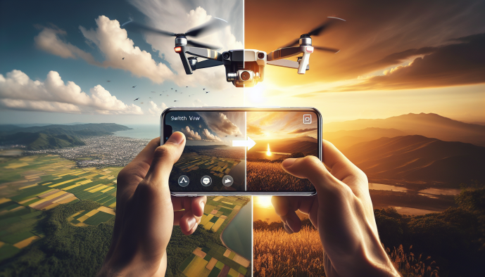
If there’s one single feature that justifies the switch to Litchi, it’s this. When I first bought my DJI Mini 2, I was genuinely surprised to learn that such a capable drone couldn’t fly a pre-programmed path using DJI’s own software. This powerful feature, known as waypoint missions, is completely absent from the DJI Fly App for many of their most popular consumer drones, including most of the Mini and Air series.
So, what exactly is a waypoint mission? In simple terms, it’s a flight path you design in advance. You plot a series of points on a map, and for each point, you can define the drone’s altitude, speed, heading, and even where the camera should be pointing (at a specific “Point of Interest” or in the direction of travel). When you launch the mission, the drone executes this complex sequence of commands autonomously, with a robotic precision that’s simply impossible to achieve with manual thumbstick control. For a deeper dive into getting started, check out this complete guide to using the Litchi app.
How This Transformed My Flying
This capability immediately opened up a new world of creative possibilities. Suddenly, I could design perfectly smooth, sweeping cinematic shots that were 100% repeatable. Imagine a slow, graceful reveal over a treeline that culminates in a perfect view of a sunset, or a flawless orbit around a historic building. With waypoints, I could nail the shot on the first try and, more importantly, I could save that mission and replicate it exactly months later to capture the same scene in a different season—the very thing I had struggled with before.
This precision is also the key to breathtaking automated hyperlapses. Trying to manually fly a slow, steady path for 20-30 minutes while the drone captures hundreds of photos is a recipe for frustration and shaky results. Litchi handles the entire process flawlessly. I just set the start and end points, define the camera parameters, and let the app do all the hard work. Learning how to plan your drone routes in Litchi is essential for unlocking this potential.

Beyond the creative aspect, waypoint missions are a powerful tool for safety and planning. If I need to fly in a complex area with obstacles like trees or power lines, I can meticulously plan a safe corridor from the comfort of my home. The drone will stick to that pre-defined path, significantly reducing the risk of an accident in a high-stress environment.
Reason 2: Planning on a Big Screen with Litchi Mission Hub
The Frustration of Mobile-Only Planning
While the DJI Fly app is designed for in-the-moment use, this becomes a significant drawback when you want to do any sort of pre-planning. Trying to set up a multi-point flight path on a 6-inch phone screen, often while standing in a field under the bright sun, is an exercise in frustration. I can’t count the number of times I’ve tried to precisely place a waypoint only to have my thumb cover half the area, or to “fat-finger” a point just slightly off from where I intended. It’s difficult to see fine details like power lines, individual trees, or subtle changes in terrain on such a small display, which can be a safety concern as well as a creative one.
The Desktop Planning Advantage
This is where Litchi introduced me to a fundamentally better workflow with its web-based Litchi Mission Hub. This is a game-changer. Instead of squinting at my phone, I can now sit comfortably at my desk and plan my entire flight on a large computer monitor. The difference is night and day. Using a mouse allows for pinpoint accuracy when placing waypoints, adjusting altitudes, and setting camera angles. I can zoom in on a satellite map to meticulously plan a path around obstacles and frame my shot perfectly before I even pack my drone bag.
This ability to plan complex, multi-point missions from the comfort of my home has transformed my process. I can take my time, refine the flight path, and save the mission. When I get to my location, I simply open the Litchi app on my phone, the mission syncs automatically, and I’m ready to fly. It removes the pressure and imprecision of on-site planning, saving valuable battery life and mental energy for focusing on the actual flight.
Reason 3: Unlocking Advanced Cinematic Modes
Going Beyond DJI’s Pre-Canned QuickShots
Don’t get me wrong, DJI’s built-in QuickShots like Dronie, Rocket, and Circle are fantastic for beginners. With a single tap, you can capture a short, shareable video clip that looks pretty impressive. However, their simplicity is also their biggest drawback. You have almost no creative control. You can’t adjust the speed, the radius of an orbit, or the camera’s angle during the maneuver. After a while, all your QuickShots start to look the same, and you begin to feel constrained by these pre-programmed templates.
Focus Mode: My Secret to Professional Shots
This is where Litchi starts to feel less like an app and more like a professional filmmaking tool. Focus Mode is a brilliant hybrid of manual control and automated precision. It allows you to select a subject or a point of interest, and the app will automatically handle all gimbal movements to keep that subject perfectly in frame. Your job? Simply fly the drone.
Imagine trying to fly a graceful, sweeping arc past a historic building while simultaneously tilting the camera down to create a dramatic reveal. Doing this smoothly with two joysticks and a gimbal wheel is a feat of coordination that frustrates even experienced pilots. With Focus Mode, you just tap the building, and Litchi takes over the camera work. You can now concentrate solely on flying the smoothest path possible, resulting in dynamic, professional-looking shots that would otherwise require a two-person crew (a pilot and a dedicated camera operator).
Track Mode: A More Versatile Subject Follow
DJI’s ActiveTrack is powerful, but it’s primarily trained to recognize and follow common subjects like people, cars, and boats. What if you want to track something else, like your dog running through a field or a kayaker on a lake? The DJI Fly app can often struggle to identify and lock onto these less conventional subjects. Litchi’s Track Mode is a more flexible visual tracking system. It allows you to draw a box around *any* object on your screen that has enough contrast from its background. The app then uses its own visual algorithms to follow that selection.
This opens up a world of creative possibilities. I’ve used it to track wildlife from a safe distance, follow a friend’s brightly colored backpack during a hike, and even create dynamic shots of boats that DJI’s system failed to recognize. It’s a more universal and often more reliable tool when your subject isn’t a person or a standard vehicle.
Reason 4: Immersive Flying with FPV and VR Mode
A Taste of the FPV World Without an FPV Drone
I’ve always been fascinated by the dynamic, high-speed world of FPV (First-Person View) flying, but the steep learning curve, cost, and separate equipment have kept me on the sidelines. Litchi offered a surprisingly effective way to dip my toes into this world without buying a new drone. By pairing my smartphone with a basic set of VR goggles, the app creates a compelling FPV experience.
The real magic, however, is the head-tracking feature. When enabled, the drone’s gimbal responds to the movement of my head. If I look up, the camera tilts up. If I pan my head to the left, the camera smoothly follows. This creates a direct, physical connection between my perspective and what the drone sees, something that tapping and dragging on a screen can never replicate. For a deeper dive into the app’s capabilities, check out our guide on using Litchi app for the first time.
Why This is More Than a Gimmick
While it might sound like a novelty, this VR mode has practical applications. For framing certain shots, especially those involving vertical reveals or complex pans, it’s far more intuitive to simply look where you want the camera to point. It removes a layer of mental translation required to operate the gimbal wheel, allowing me to concentrate more on the drone’s flight path and planning your drone routes.
Beyond its utility, it’s also just incredibly fun. On days when I’m not focused on a specific project, using the VR mode adds a new layer of engagement to a casual flight. It transforms the experience from piloting a remote camera to something closer to actually being in the air, reigniting some of the simple joy and wonder of flying.
Reason 5: Highly Customizable Panorama Shots
The Limitations of DJI’s One-Click Panoramas
Don’t get me wrong, the one-touch panorama feature in the DJI Fly app is fantastic for quickly capturing a wide vista. You select horizontal, vertical, or a 360-degree sphere, press the button, and the drone automates the entire process. It’s a brilliant feature for social media posts and for pilots who just want a simple, shareable result without any fuss.
However, for anyone serious about landscape photography, this simplicity becomes a rigid constraint. You have no control over the process. You can’t decide how many photos are taken, how much they overlap, or the final dimensions of your panorama. You’re stuck with DJI’s pre-defined settings, which can sometimes lead to stitching artifacts or fail to capture the exact field of view your composition demands.
Litchi’s Granular Control
This is where Litchi completely changes the game for aerial photographers. It hands the controls back to you, allowing for a level of precision that the stock app simply can’t match. Instead of a few presets, Litchi gives you a full suite of settings to create truly custom panoramas. If you’re new to the app, you might find using Litchi for the first time a bit daunting, but its capabilities are well worth the learning curve.
- Total Compositional Freedom: You can define the exact grid of photos you want to capture. Need an ultra-wide 5-photo horizontal shot? No problem. Want a massive 10-column by 6-row grid to capture a mountain range in breathtaking detail? You can program it in seconds. This allows you to create panoramas with unique aspect ratios tailored to your artistic vision.
- Creating “Gigapixel” Images: This level of control unlocks the ability to create what are often called “gigapixel” panoramas. By setting up a large grid, you can have the drone automatically capture hundreds of individual photos. When you stitch these together later, the result is a single image with an astronomical resolution. You can zoom in to see the tiniest details or create massive, gallery-quality prints without any loss of sharpness.
- Perfect Stitching, Every Time: Professional stitching software like PTGui or Adobe Lightroom works best with a consistent and predictable overlap between images (typically 20-30%). With DJI’s automated mode, you’re guessing what the overlap is. With Litchi, you can set the exact parameters, ensuring your source images are perfectly aligned for a seamless, error-free stitch in post-production.
For me, this transformed my drone from a simple camera in the sky into a serious tool for high-resolution landscape photography. The ability to meticulously plan and execute these complex shots ensures I get the best possible data to work with back on my computer. Learning to properly plan your drone routes in Litchi is key to unlocking these advanced panorama capabilities.
Reason 6: Reliable GPS-Based “Follow Me” (Virtual Leash)
When Visual Tracking (ActiveTrack) Isn’t Enough
DJI’s ActiveTrack is a remarkable piece of technology. When it works, it feels like magic, with the drone flawlessly following a person, car, or boat. However, I quickly discovered its Achilles’ heel: it relies entirely on what the camera can see. This visual-based system can become unreliable in less-than-perfect conditions. I’ve lost a lock on a subject during a beautiful sunset shoot simply because the low light created a silhouette. I’ve had it fail when tracking a dark-colored kayak against the shadowy water. And the most common frustration? The moment your subject passes briefly behind an obstacle—like a tree or a pillar—the lock is broken, and the shot is ruined.
The Dependability of a GPS Lock
This is where Litchi’s Follow mode offers a fundamentally more robust solution. Instead of tracking a visual subject, it creates a “virtual leash” by tracking the GPS signal of your mobile device or controller. The drone isn’t trying to *see* you; it simply knows where you are based on your controller’s GPS coordinates. This completely changes the game for certain activities.
The drone maintains a set distance and altitude relative to your controller, ignoring visual obstructions. If I’m cycling on a trail and ride behind a small group of trees, the drone doesn’t panic. It continues on its path, knowing I will emerge on the other side. This makes it an incredibly dependable tool for hands-free filming of activities in open areas. It’s perfect for boating on open water, skiing down a wide slope, or cycling through a park. The drone simply follows your GPS signal, providing a level of reliability that visual tracking often can’t match. For more on getting started with Litchi, check out our complete guide.
Reason 7: Seamless Mission Syncing Across All My Devices
The “Plan at Home, Fly on Site” Workflow
This feature is the essential link that ties the entire Litchi ecosystem together. My creative process no longer begins when I arrive at a location; it starts at my desk. I can spend as much time as I need meticulously planning a complex waypoint mission on my laptop using the web-based Litchi Mission Hub. I can zoom in on satellite maps, adjust every parameter with the precision of a mouse, and save multiple versions of a flight plan. Learning how to plan your drone routes effectively is a game-changer.
Once I save the mission, it’s instantly and automatically synced to my Litchi account in the cloud. When I get out to the field, I simply open the Litchi app on my phone, load the mission, and it’s ready to fly. There’s no exporting, no file transfers, no re-creating anything. The mission I planned on a 27-inch monitor is perfectly replicated and ready to execute from my phone.
A Major Time and Battery Saver
Before Litchi, my on-site process was often a race against the clock. I’d be squinting at my phone screen in the bright sun, trying to tap out a flight plan while my drone’s battery was just sitting there, waiting. Every minute spent fumbling with on-screen controls was a minute of potential flight time lost. This seamless syncing completely eliminates that pre-flight anxiety and inefficiency. It’s a core benefit when using Litchi app for the first time.
Now, my time in the field is dedicated purely to flying and capturing footage. The practical benefits are undeniable:
- No On-Site Programming: I arrive, power on the drone, load the pre-planned mission, and launch. The setup time is reduced to a couple of minutes.
- Maximized Flight Time: The drone’s battery power is used for the actual flight, not for sitting idle while I program a mission on a tiny screen. This is especially critical for drones with shorter flight times like the DJI Mini series.
- Reduced Stress and Errors: Planning in a calm, controlled environment at home means I’m less likely to make mistakes. I can double-check altitudes, headings, and potential obstacles without the pressure of being on location.