Geography of Bolivia
Explore Bolivia's diverse terrain, from Andean peaks to Amazonian rainforests.
Ever wondered about the dramatic landscapes that shape South America's heart? Bolivia, a landlocked nation, boasts a geography as diverse and captivating as its culture. This article will guide you through the extraordinary geographical tapestry of Bolivia, exploring its unique position and the distinct regions that define its identity.
From soaring Andean peaks to vast Amazonian lowlands, Bolivia truly is a land of extremes. We'll delve into its three major geographic zones, beginning with an in-depth look at the iconic Altiplano region. Prepare to discover the natural wonders that make Bolivia an unforgettable destination.
Essentials
A Land of Extremes: Bolivia’s Geographic Position
Landlocked in the Heart of South America
Nestled in the central part of the South American continent, Bolivia holds a unique and strategic position, though one defined by its lack of direct access to the sea. This landlocked status has profoundly shaped its history, economy, and international relations. It shares extensive borders with five neighboring countries, placing it at a continental crossroads.
- To the north and east: Brazil
- To the southeast: Paraguay
- To the south: Argentina
- To the southwest: Chile
- To the northwest: Peru
Historically, Bolivia once possessed a coastline on the Pacific Ocean. However, this territory was lost to Chile during the War of the Pacific in the late 19th century. This event remains a significant element of the national identity and continues to influence Bolivian foreign policy, which has persistently sought to regain sovereign access to the sea. Understanding this historical context is key to appreciating why Bolivia is such a compelling destination.
Key Geographical Statistics
Bolivia’s geography is a study in contrasts, encapsulated by its impressive statistics. The country covers a vast area of approximately 1.1 million square kilometers (1,098,581 sq km), making it the fifth-largest country in South America. This expansive territory hosts an astonishing range of elevations, creating diverse ecosystems. The vertical variation is immense, stretching from the snow-capped peak of Nevado Sajama, the nation’s highest point at 6,542 meters (21,463 feet), down to the low-lying plains along the Paraguay River, which sit at a modest 90 meters (295 feet) above sea level. This dramatic topography is a primary reason why Bolivia is recognized as one of the world’s most biodiverse countries, harboring a wealth of flora and fauna across its varied landscapes.
The Three Great Geographic Zones
A Nation Defined by Altitude
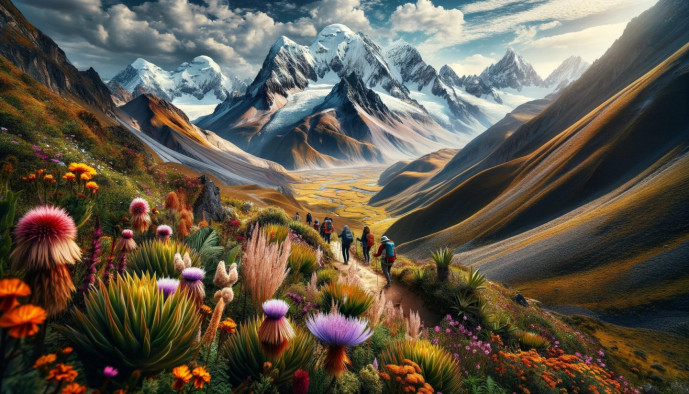
To truly understand Bolivia, one must think in terms of elevation. The country’s complex geography is elegantly simplified into three distinct zones, defined not by latitude, but by their dramatic vertical arrangement. This trifecta of landscapes shapes everything from climate and agriculture to culture and population distribution. Journeying through Bolivia is a journey through altitude, from the frigid highlands of the Andes to the temperate valleys and down into the humid Amazonian plains.
These three great regions are:
- The Altiplano: The high Andean plateau in the west, a stark and breathtaking landscape of wind-swept plains, soaring volcanic peaks, and surreal salt flats.
- The Valles and Yungas: The sub-Andean zone, a transitional area of fertile valleys and steep, cloud-forested slopes that descend from the eastern flank of the Andes.
- The Llanos: The vast tropical lowlands of the east and north, encompassing immense stretches of Amazonian rainforest, savanna, and wetlands.

The Andean Highlands: The Altiplano Region
The Altiplano is the heart of Andean Bolivia and the image that most defines the nation. This vast, high-altitude plateau, flanked by colossal mountain ranges, is a realm of stark beauty, ancient cultures, and breathtaking natural wonders. Life here is adapted to the thin air and extreme conditions, creating a landscape that is both challenging and profoundly captivating. If you’re wondering why Bolivia, the Altiplano is a major reason.
The Western Cordillera (Cordillera Occidental)
Forming a natural and formidable border with Chile, the Cordillera Occidental is a chain of dormant and active volcanic peaks. This range is characterized by its stark, arid environment, receiving very little precipitation. The landscape is a dramatic tapestry of mineral-rich, multi-colored earth and windswept plains. Dominating this volcanic procession is Nevado Sajama, a magnificent ice-capped stratovolcano that stands as Bolivia’s highest peak at 6,542 meters (21,463 feet). Its solitary presence is a landmark of the desolate but beautiful Sajama National Park.
The Eastern Cordillera (Cordillera Oriental)
In contrast to its western counterpart, the Cordillera Oriental is geologically older and receives significantly more moisture from the Amazon basin to the east. This results in a range defined by immense, glaciated peaks and deep, fertile valleys on its eastern slopes. These mountains are the source of many of Bolivia’s most important rivers. Towering over the city of La Paz, the majestic peaks of Illimani and Huayna Potosí are iconic symbols of this range, their snow-covered crowns providing a constant, awe-inspiring backdrop to urban life.
The Altiplano Plateau
Stretching for over 800 kilometers between the two great cordilleras lies the Altiplano itself, one of the most extensive high plateaus on Earth outside of Tibet. With an average elevation of about 3,750 meters (12,300 feet), this expansive plain is the cradle of Andean civilization in Bolivia. The high altitude dictates a unique way of life, with a climate characterized by intense solar radiation, low atmospheric pressure, and dramatic daily temperature swings. Despite the harsh conditions, the Altiplano is the most densely populated region of the country, home to major cities like the de facto capital La Paz, the sprawling adjacent city of El Alto, and the mining center of Oruro.
Wonders of the Altiplano
The high plateau is home to some of South America’s most iconic and otherworldly landscapes, drawing travelers, scientists, and adventurers from across the globe.
Lake Titicaca
An immense sea of sapphire-blue water set against the backdrop of the snow-capped Cordillera Real, Lake Titicaca is a geographical marvel. Recognized as the world’s highest navigable lake, its deep, cold waters create a moderating microclimate for the surrounding communities. The lake holds immense cultural and spiritual significance as the legendary birthplace of the Inca civilization. Shared with neighboring Peru, its shores and islands, such as Isla del Sol, are dotted with ancient ruins and traditional Aymara communities that continue to live in harmony with its waters. You can learn more about this unique destination in our Copacabana travel guide.
Salar de Uyuni
To the south, the Altiplano presents its most surreal spectacle: the Salar de Uyuni. This is the world’s largest salt flat, an otherworldly expanse of over 10,000 square kilometers of blindingly white salt crust. Formed from the remnants of a vast prehistoric lake, the Salar is a landscape of profound emptiness and perfect flatness. During the dry season, the ground is a mosaic of hexagonal salt tiles stretching to an infinite horizon. In the rainy season (roughly January to March), a thin layer of water transforms the flat into the world’s largest natural mirror, perfectly reflecting the sky and creating an illusion of walking among the clouds. High-quality photographs can only begin to capture the ethereal beauty of this place. Beyond its visual appeal, the Salar de Uyuni holds immense economic importance, as it sits atop the planet’s largest reserves of lithium.
The Transitional Heart: Sub-Andean Valleys and Yungas
Descending from the stark, high-altitude Altiplano, Bolivia’s geography transitions through a series of dramatic and fertile mid-altitude regions. These areas, nestled between the Andean peaks and the vast eastern lowlands, represent the country’s agricultural heartland and are characterized by a remarkable diversity of landscapes and climates.
The Valles (Valleys)
The Valles are a series of inter-Andean basins and valleys situated on the eastern slopes of the Cordillera Oriental. This region is renowned for its mild, temperate climate, often described as an “eternal spring,” which provides a welcome respite from the extremes of both the highlands and the lowlands. This agreeable weather, combined with fertile soils, has made the Valles Bolivia’s primary agricultural center.
Often referred to as the nation’s breadbasket, these valleys produce a significant portion of Bolivia’s food supply, including maize, wheat, barley, and a wide variety of fruits and vegetables. This agricultural productivity supports some of Bolivia’s most important and historic urban centers. The city of Cochabamba is celebrated for its culinary scene, while Sucre, the constitutional capital, showcases stunning colonial architecture. Further south, Tarija is the heart of Bolivia’s burgeoning wine country. You can discover more about the country’s flavors in our guide to the Gastronomy of Bolivia.
The Yungas
The Yungas represent a more abrupt and dramatic transition zone. The name refers to the steep, narrow, and deeply forested valleys that carve their way down the eastern Andean slopes, dropping precipitously towards the Amazon basin. The topography here is breathtaking, with winding roads clinging to near-vertical cliffs shrouded in mist.
The climate shifts from temperate to humid and subtropical, creating lush cloud forests where moisture from the Amazon condenses against the mountains. This unique environment is ideal for cultivating specific crops that thrive in the rich soil and high humidity, most notably coffee, citrus fruits, and coca leaves, which have been traditionally grown here for centuries. The Yungas are also a showcase of biodiversity, with dense vegetation and a rich variety of bird and insect life.
This region is famously home to the North Yungas Road, notoriously known as the “Death Road.” Once the primary route connecting La Paz to the Amazon, this narrow, unpaved track with sheer drops of hundreds of meters earned its grim moniker for its high accident rate. Today, a modern, safer highway has replaced it for most traffic, and the old road has been reborn as a world-famous destination for thrill-seeking mountain bikers. For those interested in experiencing this unique adventure, consider our guide on getting around in Bolivia, which touches upon various transport options and challenges.
The Vast Lowlands: The Llanos of the East
Descending from the Andean foothills reveals a Bolivia of staggering scale and profound contrast. The eastern lowlands, or Llanos, stretch across more than two-thirds of the country, a vast, flat expanse of forest, savanna, and wetland that feels a world away from the high-altitude austerity of the Altiplano. This is Bolivia’s tropical heart, a domain defined by powerful rivers, immense biodiversity, and a distinct rhythm of life dictated by heat and rain. If you’re considering a trip, understanding why Bolivia is a great starting point.
Amazonian Basin (Northern Llanos)
The northern and central lowlands are part of the greater Amazon Basin, a seemingly endless territory of tropical rainforest and meandering river systems. This region alone covers over half of Bolivia’s total area, forming a critical piece of the world’s most significant rainforest ecosystem. The landscape is characterized by its overwhelming greenness, high biodiversity, and the presence of colossal rivers like the Beni, Mamoré, and Madre de Dios, which serve as the primary arteries for transport and life. The climate is consistently hot and humid, with heavy rainfall shaping a world of dense vegetation and unparalleled natural richness. The department of Beni, in particular, exemplifies this zone, with its unique mosaic of rainforest and seasonally flooded savannas.
The Gran Chaco (Southeastern Llanos)
In the southeast, the landscape transitions into the Gran Chaco, a markedly different environment from the Amazon. This is a vast, semi-arid plain of dry scrubland, thorny forests, and savanna. The climate here is one of extremes, with a long, intensely hot dry season giving way to a brief but torrential wet season. This challenging environment has fostered a unique and resilient ecosystem, home to wildlife adapted to harsh conditions, including jaguars, peccaries, and giant armadillos. The Gran Chaco is one of South America’s last great wilderness frontiers, presenting significant challenges for conservation due to its fragile soils and the pressures of agricultural expansion. For travelers interested in this region, exploring out of the beaten tracks places to visit in Bolivia might reveal some of its secrets.
The Pantanal
Tucked into Bolivia’s easternmost corner is a small but ecologically precious portion of the Pantanal, the largest tropical wetland on Earth. This immense alluvial plain is a mosaic of seasonally flooded grasslands, forests, and river channels, creating a sanctuary for an extraordinary concentration of wildlife. During the wet season, the area transforms into a vast, shallow inland sea, and as the waters recede in the dry season, animals gather in dense numbers around the remaining water sources. Its exceptional biodiversity, particularly its abundance of birds, capybaras, and caimans, makes the Bolivian Pantanal a region of immense ecological importance and a prime destination for ecotourism.
Waterways of a Nation: Major Rivers and Lakes
The Three Great Basins
To truly understand Bolivia’s geography, one must look at how its water flows. The country is divided into three major hydrological basins, or watersheds. A basin is a land area where all surface water from rain and melting snow converges to a single point, like a river or lake. This concept is fundamental to grasping how Bolivia’s diverse ecosystems are interconnected, as these basins dictate the direction and fate of every drop of water, from the highest Andean peaks to the Atlantic Ocean.
Amazon Basin
Covering the northern and northeastern two-thirds of the country, this is Bolivia’s largest watershed. It is a land of immense, slow-moving rivers that meander through dense tropical rainforests. The primary rivers here are the Beni, the Mamoré, and the Madre de Dios. These powerful waterways are not just Bolivian rivers; they are major tributaries that feed the mighty Amazon River, contributing a significant volume of water and sediment to the greater Amazon ecosystem and supporting its world-renowned biodiversity.
Río de la Plata Basin
Draining the southeastern portion of Bolivia, including the Gran Chaco region, the Río de la Plata Basin directs its waters southward. Its principal rivers in Bolivia are the Pilcomayo, which forms a part of the border with Argentina, and the Paraguay River. These rivers flow through a much drier landscape of scrubland and savanna before continuing their long journey to join the Paraná River and eventually empty into the Río de la Plata estuary on the Atlantic coast. For those interested in this area, learning about best things to do in Argentina might be relevant.
Altiplano’s Endorheic Basin
Unique among the three, the Altiplano basin is endorheic, meaning it is a closed system with no outlet to the sea. Water that falls here remains within the high plateau, either collecting in lakes or evaporating under the intense Andean sun. This remarkable system includes some of Bolivia’s most iconic features: the majestic Lake Titicaca, the world’s highest navigable lake; the Desaguadero River, which flows from Titicaca to the much shallower Lake Poopó; and the final destination for much of the basin’s scarce water, the vast and otherworldly Salar de Uyuni. Visiting Copacabana, a popular gateway to Lake Titicaca, is an unforgettable experience.
A Spectrum of Climates
Bolivia’s dramatic topographical shifts result in a corresponding diversity of climates, making it a country where one can experience freezing alpine conditions and sweltering tropical heat within a few hours’ travel. This climatic variety is not just a curiosity; it fundamentally shapes the nation’s ecosystems, agriculture, and way of life. Understanding these regional differences is key to appreciating the complexity of Bolivia’s geography. If you’re wondering why Bolivia, this climatic diversity is a major draw.
Climate by Region
The country’s climate can be broadly categorized according to its three major geographic zones, each with distinct characteristics dictated by altitude and latitude.
- The Altiplano: High in the Andes, this region experiences a cold, semi-arid climate. The thin air at elevations often exceeding 3,500 meters (11,500 feet) cannot retain heat, leading to extreme diurnal temperature variations. Days can be surprisingly warm under the intense high-altitude sun, but temperatures plummet dramatically after sunset, frequently dropping below freezing, especially during the dry winter months.
- The Valles and Yungas: Nestled on the eastern slopes of the Andes, these transitional zones enjoy some of Bolivia’s most pleasant weather. The Valles are characterized by a temperate, semi-arid climate, often described as having an “eternal spring.” The Yungas, at a slightly lower elevation, have a more humid, subtropical climate, where cloud forests are common. Both regions have moderate temperatures year-round, making them fertile agricultural centers.
- The Llanos: The eastern lowlands are defined by a tropical climate. In the northern Amazon Basin, conditions are consistently hot and humid with significant rainfall, particularly during the wet season. Further south, the Gran Chaco transitions to a semi-arid climate with some of the highest temperatures on the continent during the summer, alongside a pronounced dry season that turns the landscape from green to brown.
Climatic Phenomena
Beyond the regional profiles, Bolivia’s weather is governed by larger-scale atmospheric patterns that dictate its seasons and can bring extreme events.
The most defining pattern is the division between the rainy and dry seasons. The rainy season, or summer, generally runs from November to March, bringing heavy downpours that replenish the Amazon and can cause flooding in the lowlands. Conversely, the dry season, or winter, from April to October, is characterized by clear skies, sunny days, and colder nights, especially in the highlands.
Bolivia is also significantly affected by the El Niño-Southern Oscillation (ENSO). During an El Niño event, Bolivia often experiences severe droughts in the Altiplano and Valles, impacting agriculture and water supplies, while the eastern lowlands can suffer from intense flooding. La Niña years typically bring the opposite effect, with heavier-than-average rainfall in the highlands and drier conditions in the east. These phenomena introduce a level of unpredictability to the climate, posing ongoing challenges for the country’s population and economy.
The Human Imprint: Population and Resources
Population Distribution
Bolivia’s dramatic geography has profoundly shaped where its people live and build their communities. The majority of the population is concentrated in the western third of the country, primarily across the high-altitude Altiplano and within the temperate, fertile basins of the Valles region. Cities like La Paz, El Alto, and Oruro thrive on the Altiplano, continuing settlement patterns that date back to pre-Columbian civilizations and the Spanish colonial era’s focus on high-altitude mining. Similarly, the pleasant climates of the Valles have made Cochabamba and the constitutional capital, Sucre, major agricultural and cultural centers.
In stark contrast, the expansive eastern lowlands, the Llanos, which cover more than half of the nation’s territory, are very sparsely populated. The hot, humid climate of the Amazon, combined with dense rainforest and historical isolation, has limited large-scale settlement. This demographic imbalance is a defining feature of Bolivia, where the physical environment—from altitude and temperature to soil fertility—has historically dictated the pathways of migration, infrastructure development, and economic activity.
Natural Resources and Economy
The distribution of Bolivia’s immense natural wealth is a direct reflection of its diverse geographic zones. The country’s economic story begins in the mountains, where the mineral-rich Andes have been a source of fortune and conflict for centuries. The silver extracted from Potosí’s Cerro Rico bankrolled the Spanish Empire, and today the Altiplano continues to be a vital source of tin, zinc, and silver. More recently, the focus has shifted to the vast lithium deposits beneath the Salar de Uyuni, positioning this highland region at the center of the global green energy transition.
While the Andes hold the mineral wealth, the eastern lowlands contain Bolivia’s energy reserves. Significant deposits of natural gas and petroleum are found in the sub-Andean foothills and the plains of the Gran Chaco region. These hydrocarbon resources represent a crucial component of the national economy and a counterbalance to the mineral extraction of the west.
This geographic specialization extends to agriculture and forestry. The temperate Valles serve as the nation’s breadbasket, where fertile soils yield abundant crops of maize, wheat, potatoes, and vegetables. The humid, steep slopes of the Yungas are perfectly suited for lucrative cash crops like high-quality coffee and coca leaf. Meanwhile, the vast northern Llanos support large-scale cattle ranching, sustainable timber harvesting from the Amazon rainforest, and the cultivation of soybeans and Brazil nuts, completing a national economic map drawn by the hand of geography.