Geography of Morocco
Explore Morocco's diverse landscapes, from the Atlas Mountains to the Sahara Desert.
Ever wondered what makes Morocco so captivating? It's a land sculpted by dramatic landscapes and a prime strategic position. From its ancient cities to its vibrant coastlines, Morocco's geography is an integral part of its rich history and culture. This article will explore the diverse geographical features that define this North African gem.
We'll journey from Morocco's pivotal location at the crossroads of continents to the majestic Atlas Mountains, the country's natural spine, and then venture north to discover the rugged beauty of the Rif Mountains. Prepare to uncover how these magnificent landscapes have shaped Morocco's identity and influenced its past, present, and future.
Essentials
Morocco’s Strategic Position at the Crossroads
An African Nation with a European Gateway
Nestled in the northwestern corner of Africa, Morocco occupies a unique and influential position on the world map. As a cornerstone of the Maghreb region—which also includes Algeria, Tunisia, Libya, and Mauritania—it is deeply rooted in African and Arab-Berber cultures. Yet, its geography has always oriented it towards Europe, making it a bridge between continents.
This connection is most powerfully embodied by the Strait of Gibraltar. At its narrowest point, a mere 14.3 kilometers (8.9 miles) of water separates Morocco from Spain. This legendary channel, the mythical Pillars of Hercules, is the sole natural passage between the Atlantic Ocean and the Mediterranean Sea. Throughout history, this strait has been a conduit for trade, a path for conquest, and a vessel for cultural exchange, shaping the destiny of empires from the Phoenicians and Romans to the Moors. Today, it remains one of the world’s busiest shipping lanes, a critical artery for global commerce and a constant reminder of Morocco’s role as a geostrategic pivot point.
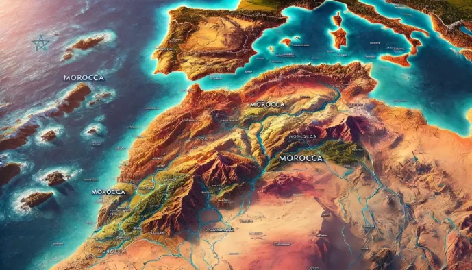
The country is located approximately between latitudes 27° and 36°N, and longitudes 1° and 14°W. It covers a total land area of about 446,550 square kilometers (172,410 square miles), not including the disputed territory of Western Sahara.
Borders and Coastlines
Morocco’s physical boundaries are defined by vast deserts, formidable mountains, and two major bodies of water. To the east and southeast, it shares a long and historically complex border with Algeria. To the south lies the territory of Western Sahara. These land borders traverse remote and often arid landscapes, starkly contrasting with the country’s extensive maritime frontiers.
To the west, Morocco is graced with a long and dramatic coastline along the Atlantic Ocean. Stretching for over 2,500 kilometers, this coast is characterized by long, sandy beaches, powerful ocean swells, and fertile plains that host the country’s largest cities and agricultural heartlands. To the north, the landscape shifts as it meets the Mediterranean Sea. This coastline is more rugged and intimate, featuring rocky cliffs, sheltered bays, and smaller coves, offering a different character from the expansive Atlantic shore.
The Atlas Mountains: The Spine of Morocco
Stretching for over 2,500 kilometers across Northwest Africa, the Atlas Mountains form the geological and cultural backbone of Morocco. This vast mountain system is not a single, uniform range but a complex series of chains, each with its own distinct character, climate, and landscape. From lush cedar forests to the highest peaks in North Africa and the arid gateways to the Sahara, the Atlas dictates the flow of water, shapes the climate, and cradles ancient Berber traditions.
The Middle Atlas
The northernmost of the three main Atlas ranges, the Middle Atlas is characterized by its gentler slopes and verdant landscapes. It is a region of remarkable biodiversity, with extensive forests of giant cedar, juniper, and oak. These forests are famously home to troops of Barbary macaques, the only primate species native to Africa north of the Sahara. Towns like Ifrane, with its alpine architecture and cool climate, and Azrou, a bustling Berber market center, serve as key gateways to the region’s natural parks and highlands. Beyond its beauty, the Middle Atlas plays a crucial role as Morocco’s primary water catchment area, feeding some of the nation’s most important rivers and sustaining life far beyond its peaks.
The High Atlas
The High Atlas is the most formidable and dramatic of the ranges, a rugged wall of rock and ice that separates the mild Atlantic coast from the harsh Sahara. This is the highest mountain range in North Africa, culminating in the majestic peak of Jebel Toubkal, which stands at an impressive 4,167 meters (13,671 feet). Toubkal is a beacon for trekkers and mountaineers from around the world, offering challenging ascents and unparalleled panoramic views of the surrounding landscape. The range’s immense height creates a significant rain shadow effect, intercepting moisture-laden winds from the Atlantic and leaving the lands to its south and east significantly drier. Nestled within its deep valleys are traditional Berber villages, where stone houses cling to steep hillsides and communities continue to practice age-old terraced farming, creating vibrant green steps in an otherwise stark environment.
The Anti-Atlas
Running southwest from the High Atlas and bordering the Sahara, the Anti-Atlas is the oldest and most arid of the ranges. Its landscape is a geologist’s dream, a stark and ancient terrain of exposed, folded rock layers, deep gorges, and vast, sun-baked plateaus. It is a land of dramatic contrasts, rich in mineral resources like copper and silver. The Anti-Atlas lacks the green forests of its northern counterparts, but its beauty is no less profound. One of its most distinctive features is found near the town of Tafraoute, where colossal granite boulders have been painted in vibrant hues of blue, pink, and yellow, an open-air art installation that adds a surreal touch to the primordial landscape.
The Rif Mountains of the North
A Coastal Mountain Chain
Stretching along Morocco’s northernmost edge, the Rif Mountains form a rugged arc that runs parallel to the Mediterranean Sea, from the Strait of Gibraltar in the west to the Moulouya River in the east. This range is a distinct geographical and cultural entity, separate from the more extensive Atlas system that dominates the country’s interior.
Geologically, the Rif is part of the Baetic System that also forms the mountains of Andalusia in southern Spain, a testament to the tectonic collision of the African and Eurasian plates. This shared origin distinguishes it from the Atlas Mountains. The separation has also fostered a unique cultural identity among the Rifian people, whose traditions and dialects have developed in relative isolation within these protective valleys.
The landscape of the Rif is a surprising contrast to Morocco’s more arid regions. It is characterized by green, fertile valleys, extensive cork oak forests, and rugged limestone peaks that catch moisture-laden winds from the sea, making it one of the wettest parts of the country. This environment provides a dramatic and verdant backdrop to the Mediterranean coast.
This unique geography is the cradle for some of Morocco’s most picturesque cities. Tucked into a fold of the mountains is Chefchaouen, the famous “Blue Pearl,” whose azure-washed walls stand in stunning contrast to the surrounding green peaks. Further north, Tetouan, known as the “White Dove,” lies at the foot of the Rif, its Hispano-Moorish architecture a testament to centuries of cultural exchange. The challenging terrain of the Rif has historically provided a natural fortress for these communities, allowing them to develop and preserve distinct traditions away from the central powers of the imperial cities.
Coastal Plains and Fertile Lowlands
Stretching between the mountains and the sea, Morocco’s coastal plains are the nation’s economic and agricultural heartland. These low-lying regions are where the majority of the population lives and works, shaped by the contrasting influences of the Atlantic Ocean and the Mediterranean Sea.
The Atlantic Coastal Plain
The Atlantic coastal plain is a vast, fertile corridor that extends from Tangier in the north down past Agadir in the south. This region is the breadbasket of Morocco, containing some of its most productive agricultural lands. The expansive Gharb and Doukkala plains, blessed with rich alluvial soils and fed by rivers flowing from the Atlas, yield abundant crops of citrus fruits, vegetables, grains, and sugarcane.
This agricultural wealth has historically supported dense populations and fueled economic growth. It is no surprise that this plain is home to Morocco’s most significant urban and industrial centers. The dynamic metropolis of Casablanca, the nation’s economic engine, sits on this coast, as does the political capital, Rabat. Further south, cities like Safi serve as vital ports for fishing and the export of phosphates and agricultural goods, anchoring the region’s role as the core of modern Morocco.
The Mediterranean Coast
In contrast to the broad, sweeping plains of the Atlantic, Morocco’s Mediterranean coastline presents a more rugged and dramatic landscape. Here, the Rif Mountains often descend sharply to the sea, creating a coastline characterized by rocky headlands, sheltered bays, and secluded coves. This topography limits the potential for the kind of large-scale agriculture seen on the Atlantic side.
While less of an agricultural powerhouse, this coast has its own strategic and economic importance. It is dotted with key ports and fishing towns that have long facilitated trade and cultural exchange across the sea. In modern times, its scenic beauty has made it a center for tourism, with resort towns like Saidia, known for its long sandy beach, and the port city of Al Hoceima, nestled in a picturesque bay, attracting visitors seeking the unique character of Morocco’s northern shore.
The Vast Sahara Desert
Beyond the southern slopes of the Atlas Mountains, Morocco transforms into a landscape of profound silence and immense scale. This is the Sahara, a realm not of emptiness, but of subtle life, dramatic horizons, and ancient human adaptation. It represents the country’s eastern and southern frontier, a world that has captivated travelers, artists, and nomads for millennia.
The Eastern and Southern Frontier
The journey into the Moroccan Sahara is not an abrupt change but a gradual transition. As one descends from the arid, mineral-rich peaks of the Anti-Atlas, the terrain slowly softens and flattens. The landscape opens into vast, pre-Saharan steppes, known as hamada. These are expansive, sun-baked plateaus of rock and gravel, a stark and minimalist environment that serves as the gateway to the true desert. This stony desert floor, stretching for miles, is a testament to the power of wind and time, preparing the traveler for the even more iconic landscapes that lie ahead.
Landscapes of the Moroccan Sahara
The Moroccan Sahara is a mosaic of distinct environments, each with its own unique character and beauty. Far from being a uniform expanse, it is a dynamic region defined by sand, rock, and precious sources of water.
Ergs: Seas of Sand
When most imagine the Sahara, they picture the great sand seas, or ergs. These are landscapes of pure poetry, where colossal dunes are sculpted by the wind into ever-changing forms. In Morocco, two ergs are particularly famous. Erg Chebbi, near Merzouga, presents a breathtaking wall of sand, with dunes rising hundreds of feet. Their colors shift dramatically throughout the day, from soft peach at dawn to a fiery orange at sunset, finally settling into pale silver under a canopy of brilliant stars. Further south and more remote lies Erg Chigaga, a wilder and more expansive sea of sand. Reaching it requires a more rugged journey, but the reward is a profound sense of isolation and immersion in an undulating ocean of golden dunes that stretch to the horizon.
Regs: Rocky Desert Plains
Contrary to popular imagination, the majority of the Sahara consists of regs, or rocky desert. These are vast, flat plains covered in dark, polished stones and gravel, scoured clean by the wind. While less photogenic than the ergs, the regs possess a stark, powerful beauty of their own. They are landscapes of immense scale and perspective, where the sky feels impossibly large and the silence is absolute. Traveling across a reg offers a true sense of the desert’s resilience and ancient, unchanging nature.
Oases: Ribbons of Life
Interrupting the arid expanse are the oases, verdant corridors of life that are the heart and soul of the Sahara. Fed by underground springs or rivers like the Ziz and the Draa, these areas are dense with millions of date palms, creating a life-sustaining canopy for small plots of grain, vegetables, and fruit trees. The Draa Valley is a spectacular example, a long, winding ribbon of green that snakes through the desert for over a hundred miles. The Tafilalt Oasis, one of the largest in the world, has been a vital center for trans-Saharan trade for centuries. These oases are not just ecological wonders; they are cradles of civilization, home to historic fortified villages (ksour) and a testament to humanity’s ability to thrive in the most challenging of environments.
Water Resources: The Lifeline of the Nation
In a country defined by both towering, snow-capped mountains and vast, arid deserts, water is the thread that ties the landscape together. Morocco’s rivers, born in the Atlas ranges, dictate the patterns of settlement, agriculture, and life itself. The management of this precious resource is a testament to the nation’s ingenuity and a reflection of its most pressing environmental challenges.
Major River Systems
The flow of Morocco’s rivers tells a story of two distinct destinations. Some journey north to the seas, while others venture south to nourish oases before succumbing to the Sahara. Each system carves out a unique corridor of life.
- Moulouya River: Rising in the Middle Atlas, the Moulouya is the principal river of eastern Morocco. It flows over 500 kilometers northeastward, creating a vital basin for agriculture before emptying into the Mediterranean Sea near the border with Algeria.
- Sebou River: Originating in the same mountainous region, the Sebou River is Morocco’s largest by volume. It charts a course westward, irrigating the incredibly fertile Gharb Plain, the nation’s breadbasket, before meeting the Atlantic Ocean near Kenitra. Its basin is one of the most economically important in the country.
- Draa and Ziz Rivers: These two rivers represent the lifeblood of the pre-Saharan south. Flowing from the High Atlas, they do not reach the sea. Instead, the Ziz River feeds the massive Tafilalt oasis, while the Draa River carves out the Draa Valley, the longest stretch of oases in Morocco. Their waters sustain millions of date palms and ancient communities before disappearing into the sands of the desert.
Water Management and Challenges
Harnessing this water has been a priority for Morocco for decades. The country has constructed an extensive network of dams and reservoirs, most notably the Al Wahda Dam on the Ouergha River (a tributary of the Sebou). These structures are crucial for providing a stable supply of drinking water to burgeoning cities, generating hydroelectric power, and supporting the large-scale irrigation that underpins the nation’s agricultural sector.
Despite these efforts, Morocco faces a significant challenge in water scarcity. A combination of factors, including recurrent droughts linked to climate change, reduced snowpack in the Atlas Mountains, and a steadily increasing demand from agriculture and a growing population, is placing immense pressure on this finite resource. Ensuring a sustainable water future is one of the most critical geographical and political issues for Morocco in the 21st century.
A Mosaic of Climates
Morocco’s diverse topography gives rise to a remarkable variety of climates, often within a few hours’ drive of each other. This climatic complexity is a defining feature of the country, shaping everything from its agriculture to its architecture. From the sun-drenched coasts to snow-capped peaks and the vast desert, Morocco offers a climate for nearly every preference.
Mediterranean Climate
Along the northern coastline and within the Rif Mountains, Morocco enjoys a classic Mediterranean climate. This region, encompassing cities like Tangier and Tetouan, is characterized by hot, dry summers where sunshine is abundant. The winters are typically mild and wet, bringing the necessary rainfall that sustains the green, fertile landscapes of the north. This pleasant climate has made the Mediterranean coast a popular destination for both Moroccans and international visitors seeking coastal retreats.
Oceanic and Semi-Arid Climates
The extensive Atlantic coast, from Asilah down to Essaouira and beyond, is governed by a milder oceanic climate. The cool Canary Current offshore acts as a natural air conditioner, moderating temperatures throughout the year. This results in warm, pleasant summers without the intense heat of the interior, and exceptionally mild winters. Cities like Rabat and Casablanca benefit from this gentle climate. As one moves inland from the coast, the oceanic influence wanes, and the climate transitions to a semi-arid one. The plains around Marrakech, for instance, experience hotter summers and cooler winters than the coast, marking the shift towards a more continental climate pattern.
Mountain and Desert Climates
The country’s interior presents the most dramatic climatic contrasts, dictated by altitude and the formidable barrier of the Atlas Mountains.
Alpine Climate
In the high-altitude regions of the High Atlas and Middle Atlas, an alpine climate prevails. Winters here are cold and often harsh, with significant snowfall that can blanket peaks like Jebel Toubkal for months. This winter snowpack is a crucial source of water for the plains below. Summers are mild and pleasant, providing a cool escape from the heat of the lowlands and making the mountains a prime destination for trekking.
Arid Desert Climate
South and east of the Atlas Mountains lies the immense Sahara. This region is defined by an arid desert climate with very little rainfall. The most notable characteristic is the extreme diurnal temperature range. Daytime temperatures can soar, especially in summer, while nights can become surprisingly, and in winter, bitterly cold as the clear skies allow heat to radiate away rapidly. This is the climate of the great ergs and rocky hamadas, a land of stark beauty and incredible resilience.
How Geography Shapes Life and Culture in Morocco
Population Distribution and Urban Centers
Morocco’s diverse geography has profoundly influenced where its people have chosen to live for centuries. The population is not evenly distributed; instead, it is concentrated in the more hospitable regions west of the Atlas Mountains. The fertile Atlantic coastal plains, from Tangier down to Agadir, and the foothills of the Atlas ranges are the most densely populated areas, benefiting from reliable rainfall, richer soils, and milder climates.
This settlement pattern explains the strategic placement of Morocco’s great Imperial Cities. Fes and Meknes are nestled in the fertile Saïs plain, a crossroads of ancient trade routes with access to water from the Middle Atlas. Marrakech, the “gateway to the south,” was established at the foot of the High Atlas, perfectly positioned to control the lucrative trans-Saharan trade caravans carrying salt, gold, and spices. These cities thrived not by chance, but by their masterful command of geography, controlling vital resources and commercial arteries.
Agriculture and Natural Resources
The country’s varied landscapes give rise to distinct agricultural zones. In the north and west, the Mediterranean and oceanic climates support vast groves of citrus fruits, olives, and argan trees, alongside fields of grain and vegetables that form the backbone of the national diet. This region is Morocco’s agricultural heartland. In contrast, south of the High Atlas, agriculture adapts to scarcity. Here, life clusters around oases, where resilient date palms provide shade, food, and building materials, creating ribbons of green in the arid pre-Saharan lands.
Beyond its fields, Morocco’s land is rich in valuable resources. The country is one of the world’s largest producers and exporters of phosphates, a key ingredient in agricultural fertilizers. Its extensive Atlantic coastline supports a vibrant fishing industry, a crucial part of both the economy and the coastal cuisine. More recently, Morocco has begun to harness its most abundant resource: the sun. The vast, sun-drenched expanses of the Sahara are now home to some of the world’s largest concentrated solar power plants, positioning the nation as a leader in renewable energy.
Culture, Architecture, and Livelihoods
The direct relationship between the Moroccan people and their environment is most visibly expressed in their traditional architecture and ways of life. In the south, on the fringes of the desert, the landscape is dotted with magnificent earthen structures. Fortified family homes known as kasbahs and entire fortified villages called ksour were built using local earth and straw. Their thick walls, high ramparts, and narrow windows provided defense against both invaders and the extreme desert climate.
Lifestyles are similarly shaped by the land. The fertile plains have long supported a culture of settled farming and vibrant urban markets. In the High Atlas, the Amazigh (Berber) people have practiced a form of semi-nomadic pastoralism for millennia, moving their herds to high pastures in the summer and returning to valley villages in the winter. In the Sahara, the nomadic traditions of the Tuareg and other groups, though diminished, speak to a life adapted to the constant search for water and pasture in the immense desert expanse. From the bustling medinas of the coast to the quiet oases of the desert, the geography of Morocco is the silent architect of its culture.