Geography of Guatemala
Explore Guatemala's geography: from mountains to coastal areas
Ever wondered what makes Guatemala so captivating? From mist-shrouded volcanoes to vibrant coastlines, this Central American gem boasts a truly diverse landscape. If you're curious about Guatemala's geographic wonders, you've come to the right place.
This article will guide you through the essential elements of Guatemala's geography, exploring its strategic location, the three major regions that define its terrain, and the crucial role of its abundant lakes and rivers. Prepare to discover the natural forces that have shaped this remarkable country.
Essentials
Guatemala’s Place on the Map
Central American Keystone
Nestled in the heart of the Americas, Guatemala serves as a vital land bridge connecting the North and South American continents. This strategic position on the Central American isthmus has profoundly shaped its history and identity, making it not just a geographic link but also a significant cultural and biological crossroads. Here, ancient Mesoamerican traditions converge with colonial history, and unique ecosystems host species from two distinct continental biomes, creating a landscape rich in both heritage and biodiversity.
Borders and Boundaries
Guatemala shares extensive land borders with four neighboring countries, defining its regional context. To its north and west lies its largest neighbor, Mexico, with a long and historically significant boundary. A much smaller border to the northeast is shared with Belize. To the southeast, Guatemala is flanked by Honduras and, along a shorter stretch, El Salvador, creating a complex and dynamic regional tapestry.
Coastal Access
Despite its mountainous interior, Guatemala possesses valuable access to two major bodies of water. A long, sweeping coastline to the southwest meets the Pacific Ocean, characterized by its distinctive dark volcanic sand beaches and fertile plains. On its eastern edge, a small but significant sliver of territory opens onto the Caribbean Sea via the Gulf of Honduras, providing a crucial link to the Atlantic and a different coastal environment of lush estuaries and warmer waters.
Size and Scale
Covering a total area of approximately 108,889 square kilometers (42,042 square miles), Guatemala is a country of considerable geographic diversity packed into a relatively compact space. To put its size into perspective, it is roughly equivalent to the U.S. state of Tennessee or the European nation of Iceland. This scale means that dramatic shifts in landscape, from humid coastal plains to cool, towering volcanoes, can often be experienced within a single day’s journey.
The Three Dominant Geographic Regions
Guatemala’s dramatic landscape is not uniform; it is a country of profound contrasts, neatly divisible into three distinct geographic zones. From the cool, volcanic peaks of the highlands to the steamy coastal plains and the vast, jungle-cloaked lowlands of the north, each region possesses a unique character, climate, and cultural identity that has shaped the nation’s history and modern life.
The Mountainous Highlands (Altiplano)
The highlands are the physical and cultural backbone of Guatemala, a rugged expanse of mountains and volcanoes that covers the southern and western parts of the country. This region is defined by its dramatic elevation, temperate climate, and deep-rooted indigenous traditions. It is here that the majority of Guatemala’s population lives, in cities and villages nestled within breathtaking scenery.
Key Mountain Ranges
Two primary mountain systems form the core of the Altiplano:
- The Sierra Madre de Chiapas: Entering from Mexico, this range runs parallel to the Pacific coast and forms the main continental divide. It is the southern chain that contains the country’s famous volcanic axis.
- The Sierra de los Cuchumatanes: Located further north, this massive limestone formation is the highest non-volcanic mountain range in Central America, with peaks soaring over 3,800 meters. It is a more remote and culturally distinct area.
The Volcanic Axis
As part of the Pacific Ring of Fire, Guatemala is home to a chain of over 30 volcanoes, creating one of the most visually stunning and geologically active landscapes in the world. Several of these volcanoes remain active, serving as a constant reminder of the earth’s power. Notable peaks include:
- Volcán Tajumulco: At 4,220 meters (13,845 feet), this is the highest point not only in Guatemala but in all of Central America.
- Fuego: Aptly named “Fire,” this volcano is one of the most active, often producing spectacular but dangerous eruptions of ash and lava.
- Pacaya: A popular destination for hikers, Pacaya frequently offers visitors the chance to see slow-moving lava flows.
- Acatenango: A challenging climb that rewards trekkers with incredible views of its erupting neighbor, Fuego.
Highland Valleys and Population
Tucked between the towering peaks are numerous fertile, high-altitude valleys. These areas, with their rich volcanic soils and pleasant, spring-like climate, have been centers of civilization for millennia. Today, they contain Guatemala’s highest population density, including the capital, Guatemala City, and the colonial jewel of Antigua. The highlands remain the heartland of the indigenous Maya population, where traditional languages, clothing, and customs continue to thrive.
The Pacific Lowlands (Costa Sur)
Stretching along the country’s southwestern edge is a relatively narrow but economically vital plain known as the Pacific Lowlands, or Costa Sur. This region slopes gently from the volcanic foothills of the highlands down to the Pacific Ocean, creating a landscape and climate that are worlds away from the Altiplano.
With a hot, humid, and tropical climate, the Costa Sur is characterized by its flat terrain and immense agricultural productivity. The rivers that tumble down from the highlands deposit rich volcanic silt across the plain, making it one of the most fertile areas in the country.
Economic Engine
The rich soils of the Pacific Lowlands are the engine of Guatemala’s large-scale export agriculture. Vast plantations, or fincas, dominate the landscape, dedicated to producing key commodities. Major crops cultivated here include sugarcane, bananas, coffee (at the foothills), cotton, and rubber.
Coastal Features
The coastline itself is distinct from the Caribbean’s white-sand beaches. Here, the shores are lined with striking black sand, a direct result of the country’s volcanic geology. The coast is also dotted with important mangrove swamps and estuaries, which serve as critical habitats for a variety of marine and bird life.
The Petén Lowlands
Covering the entire northern third of Guatemala is the Petén, a vast and sparsely populated region that contrasts sharply with the rest of the country. This immense, undulating limestone plateau is dominated by dense tropical rainforest and is a sanctuary for both wildlife and history.
The topography is primarily low-lying, though it is interspersed with rolling hills and seasonal wetlands known as bajos. This jungle environment is one of the most important biological corridors in the Americas.
The Maya Biosphere Reserve
Much of the Petén is protected within the Maya Biosphere Reserve, the largest continuous tract of tropical forest in Central America. This vital reserve is a hotspot of biodiversity, providing a habitat for iconic species such as the jaguar, puma, howler and spider monkeys, and hundreds of species of birds, including the elusive Resplendent Quetzal.
Historical Significance
The Petén is the cradle of the ancient Maya civilization. For centuries, this region was the heart of a powerful network of city-states. The geography of the area was instrumental to their success. The abundant limestone of the plateau provided an endless supply of material for constructing their magnificent pyramids, temples, and palaces. Furthermore, the Maya engineered sophisticated water management systems, using natural depressions and constructing reservoirs to collect and store rainwater, allowing monumental cities like Tikal, Uaxactún, and the massive early metropolis of El Mirador to thrive in an environment with a pronounced dry season. Today, the ruins of these great cities emerge from the jungle canopy, offering a profound connection to Guatemala’s ancient past.
Hydrography: A Land of Lakes and Rivers
Water is the lifeblood of Guatemala, carving canyons through its volcanic highlands, meandering across its vast lowlands, and pooling in some of the world’s most breathtaking lakes. The country’s dramatic topography creates a continental divide that directs its extensive network of rivers towards three distinct basins, shaping the landscape and the lives of those who inhabit it.
Major River Systems
Guatemala’s rivers are defined by their journey from the central highlands to the sea. This watershed gives rise to three primary drainage systems, each with unique characteristics.
- Pacific Drainage Basin: Rivers originating on the southern slopes of the Sierra Madre are numerous but tend to be short, steep, and fast-flowing. They descend rapidly from the highlands, carving deep ravines before emptying into the Pacific Ocean. Notable examples include the Río Suchiate, which forms a part of the border with Mexico, and the Río Samalá.
- Caribbean Drainage Basin: To the east, rivers flow more gradually towards the Caribbean Sea. These waterways are longer, deeper, and carry a greater volume of water. The most significant is the Río Motagua, Guatemala’s longest river, which flows through a major valley. The scenic Río Dulce drains the country’s largest lake and is a vital waterway for both commerce and nature.
- Gulf of Mexico Drainage Basin: The northern region of the country, particularly the Petén, is drained by rivers that flow towards the Gulf of Mexico. The most prominent among these is the mighty Usumacinta River system, which creates a natural and historical boundary between Guatemala and the Mexican state of Chiapas.
Iconic Lakes
Guatemala is as famous for its still waters as it is for its flowing rivers. The country is home to several stunning lakes, each a centerpiece of its respective region and a hub of ecological and cultural importance.
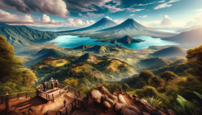
- Lake Atitlán: Often cited as one of the most beautiful lakes in the world, Lake Atitlán fills a massive caldera formed by a volcanic eruption tens of thousands of years ago. It is the deepest lake in Central America, and its shores are flanked by three towering volcanoes: Atitlán, Tolimán, and San Pedro. The lake is a cultural heartland, surrounded by traditional Maya villages where life continues much as it has for centuries.
- Lake Izabal (Lago de Izabal): By surface area, this is Guatemala’s largest lake. This vast, shallow body of freshwater is a critical habitat for a diverse range of wildlife, including manatees and numerous bird species. It is fed by several rivers and drains into the Caribbean Sea through the lush gorge of the Río Dulce.
- Lake Petén Itzá: Situated in the heart of the northern Petén Lowlands, this large lake is best known for the picturesque island city of Flores, the capital of the Petén department, which sits upon its southern shore. The lake was a crucial water source for the ancient Maya and remains a central feature of the region today.
Climate, Weather, and Natural Hazards
Guatemala’s dramatic topography creates a surprisingly diverse range of microclimates. Rather than four distinct seasons, the country’s weather is primarily defined by altitude and a pronounced wet and dry season. This dynamic environment, while beautiful, also comes with inherent geologic and atmospheric risks that have shaped both the land and its people.
Climatic Zones by Altitude
Traveling through Guatemala can feel like moving through different worlds in a single day, largely due to the vertical climate zones. Temperature is less about the time of year and more about how high you are above sea level. You can learn more about the weather and climate in Guatemala to help plan your trip.
- Tierra Caliente (Hot Land): Found from sea level up to about 800 meters, this zone encompasses the Pacific and Caribbean lowlands, as well as the vast Petén region. It is characterized by consistently hot, humid, and tropical conditions, ideal for growing bananas and sugarcane.
- Tierra Templada (Temperate Land): Ranging from 800 to 2,000 meters, this is the region often called the “Land of Eternal Spring.” The highlands, including Guatemala City, Antigua, and the area around Lake Atitlán, fall within this zone. It boasts a pleasant, mild climate year-round, which is why it supports the majority of Guatemala’s population.
- Tierra Fría (Cold Land): Above 2,000 meters, the air becomes crisp and cool. This “Cold Land” includes the highest mountain ranges and plateaus, such as Quetzaltenango and the upper slopes of the volcanoes. Nights can be genuinely cold, and frost is not uncommon at the highest elevations.
Seasonal Patterns
Guatemala’s year is neatly divided into two primary seasons, known locally as summer and winter, though they don’t correspond to temperature changes in the same way they do in more northern or southern latitudes.
- Dry Season (Verano): Lasting from November to April, this is Guatemala’s “summer.” It is characterized by abundant sunshine, clear skies, and very little rainfall, especially in the highlands and Pacific region. This period is generally considered the most popular time for tourism.
- Wet Season (Invierno): From May to October, the “winter” brings the rains. Typically, this means bright, sunny mornings followed by heavy afternoon downpours. While the rain revitalizes the landscape, turning it a brilliant, lush green, it can occasionally cause travel disruptions.
Geologic and Atmospheric Risks
The same forces that created Guatemala’s stunning volcanoes and mountains also make it a region of significant natural hazards. The country’s position is a convergence point for powerful natural phenomena.
- Earthquakes: Guatemala is situated at the complex junction of three tectonic plates: the North American, Caribbean, and Cocos plates. This active seismic setting makes the country prone to frequent tremors and occasional powerful earthquakes.
- Volcanic Eruptions: As a key part of the Pacific Ring of Fire, Guatemala is home to numerous volcanoes. Several, including the highly active Volcán de Fuego and Pacaya, pose a constant threat of eruption, releasing ash, gas, and lava flows.
- Hurricanes: With coastlines on both the Pacific Ocean and the Caribbean Sea, Guatemala is vulnerable to tropical storms and hurricanes. These systems can bring destructive winds and torrential rainfall, leading to widespread flooding, particularly in the low-lying coastal areas.
- Landslides and Mudflows (Lahars): The combination of steep volcanic slopes, loose soil, and heavy seasonal rains creates a high risk of landslides. During the wet season, intense rainfall can saturate the ground, triggering devastating mudflows. On volcanic slopes, these flows, known as lahars, can be particularly dangerous.
Biodiversity and Natural Resources
A Megadiverse Country
Guatemala’s dramatic and varied topography has fostered an extraordinary level of biodiversity, earning it a designation as one of the world’s megadiverse countries. The convergence of different altitudes, climates, and soil types creates a mosaic of distinct habitats, each supporting a unique web of life. From humid lowland jungles to misty highland peaks, the country is a living laboratory of ecological richness.
This biological wealth is distributed across several key ecosystems:
- Tropical Rainforests: Covering the vast Petén lowlands, these forests are part of the larger Selva Maya and host a staggering number of species within their dense, humid canopy.
- Cloud Forests: Found in the upper reaches of the highlands, these perpetually moist, high-altitude forests are draped in mosses, ferns, and orchids, creating an ethereal environment for specialized fauna.
- Mangrove Forests: Along both the Pacific and Caribbean coasts, these vital estuarine ecosystems serve as critical nurseries for marine life and protect the coastline.
- Dry Scrubland: In the rain shadow of the mountains, particularly within the Motagua Valley, is a region of dry forest and scrubland adapted to more arid conditions.
This tapestry of habitats is home to a remarkable array of fauna. The nation’s most iconic resident is the Resplendent Quetzal, Guatemala’s national bird, which thrives in the cloud forests. The remote jungles of Petén provide a sanctuary for elusive felines such as the jaguar, puma, and ocelot. In the forest canopy, the calls of howler and spider monkeys are a common sound. The country is also a crucial stopover for migratory birds and boasts an immense variety of resident birdlife, insects, and a spectacular diversity of native orchids.
Economic Resources from the Land
The same geographic features that create Guatemala’s biodiversity also provide a wealth of natural resources that have shaped its economy for centuries. The land is not only ecologically rich but also materially productive, supporting both traditional livelihoods and large-scale industries.
- Agriculture: The country’s fertile volcanic soils, particularly in the highlands and Pacific lowlands, are the foundation of its agricultural sector. Guatemala is a world-renowned producer of high-quality coffee and a leading global exporter of cardamom. Other significant crops include bananas, sugarcane, and rubber.
- Forestry: The extensive forests contain valuable timber resources, including both hardwoods like mahogany and cedar, and various softwoods. Sustainable management of these resources is a continuous challenge and priority.
- Minerals: Beneath the surface, Guatemala holds significant mineral deposits. The country is a notable producer of nickel. Historically and culturally important, jade is still mined, alongside deposits of silver, gold, and antimony.
- Hydropower: The numerous rivers that descend from the mountainous highlands present considerable potential for hydroelectric power generation, a resource that is increasingly harnessed to meet the country’s energy needs.
The Human-Geography Connection
Population Distribution and Landscape
In Guatemala, the landscape is not merely a backdrop for life; it is the primary force that has shaped where and how people live for centuries. The country’s population is far from evenly distributed, with settlement patterns directly corresponding to altitude, climate, and historical precedent. This intimate relationship between people and place is a defining characteristic of the nation’s identity.
- The Highlands: This mountainous core is the most densely populated region of Guatemala. The temperate climate of the Tierra Templada, often called the “Land of Eternal Spring,” provides comfortable living conditions and allows for year-round agriculture in its fertile valleys. Historically, this has been the heartland of the indigenous Maya communities, and major cities, including Guatemala City and Antigua, are nestled within these high-altitude basins.
- The Pacific Coast: The population along the Costa Sur is concentrated in specific areas related to its economic function. Large agricultural plantations, or fincas, dedicated to sugarcane, bananas, and rubber, have created centers of employment. Consequently, towns and cities have grown around these estates and near vital port cities like Puerto Quetzal, which serve as hubs for international trade.
- The Petén: In stark contrast, the vast northern lowlands of Petén remain sparsely populated. This is almost entirely due to the dense, and often inhospitable, tropical rainforest that covers the region. The majority of the department’s residents live in or around the urban center of Flores and the neighboring town of Santa Elena, which serve as the gateway to the region’s natural and archaeological treasures.
How Geography Shapes the Economy
Guatemala’s economy is fundamentally tied to its diverse topography and natural resources. From the rich volcanic soils that produce world-class crops to the dramatic scenery that attracts visitors from around the globe, the land is the nation’s most significant economic asset. However, this same geography also presents formidable challenges to development.
- Coffee Cultivation: The volcanic slopes of the Sierra Madre are the key to one of Guatemala’s most famous exports: coffee. The high altitudes, consistent rainfall, and nutrient-rich soil create the ideal conditions for growing high-quality Arabica beans. Regions like Antigua, Huehuetenango, and Atitlán are globally renowned for their distinct coffee profiles, an industry entirely dependent on this specific mountain geography.
- Tourism: The tourism industry is a direct reflection of Guatemala’s geographic wonders. The country’s appeal is built upon its dramatic landscapes. Travelers are drawn to hike active volcanoes like Pacaya and Acatenango, to experience the profound beauty of Lake Atitlán surrounded by its three volcanic sentinels, and to explore the ancient Maya cities like Tikal, which rise majestically from the jungle canopy of the Petén.
- Infrastructure Challenges: The very same mountainous terrain that makes Guatemala beautiful also poses significant obstacles. The steep slopes, deep ravines, and geologic instability make the construction and maintenance of roads, bridges, and railways exceptionally difficult and expensive. This can lead to the isolation of rural communities, hindering their access to markets, education, and healthcare, and complicating national economic integration.