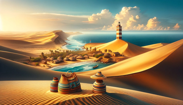
In an incomparable panoramic view, the Guajira Peninsula stands out in the imposing Caribbean Sea, the northernmost tip of Colombia and South America, surrounded by beautiful and calm blue waters and decorated with the immense colorful Wayúu handicrafts, an ethnic population that inhabits these exotic lands.
The indomitable character and the very way of life of the indigenous population is a true reflection of a race that resisted Spanish subjugation.
Ecotourism in La Guajira has outstanding potential for national and international recognition. To this end, several products are being developed and various alternatives are being considered to take advantage of the comparative advantages of natural and cultural attractions and current demand trends. The Wayúu way of life is an indication of the influence of the culture of the Arawak and Carib ancestors, who were characterized by their fierce resistance to the Spanish yoke.
Sun, mountains, desert, beach, and a special human potential, mostly endogenous and raizal, mark this department as a different and unexpected region in the entire Caribbean area, where reality is confused with fantasy.
Visiting La Guajira is an out-of-the-ordinary experience, where you will learn about the perfect harmony between man and his environment. From the settlements of the people who guard the Sierra Nevada de Santa Marta to the Wayúu who live together in the desert and demonstrate the balanced way in which the Guajiro builds and protects their natural environment.
The environmental and ethnic elements have created the department’s own identity, cradle of transcendental emblematic manifestations of the Republic of Colombia such as vallenata music, the legacy of Francisco El Hombre, the magical realism of the writer García Márquez and the tradition of the National Navy influenced by the heroic deed of Admiral Padilla.
Riohacha
This large seaside resort is the starting point for a 4×4 trip to La Guajira, a region populated by the Wayuu (or Guajiros), an Amerindian people living mainly from weaving (clothes, hammocks …) and fishing.
Not far from there is the sanctuary of Los Flamencos, an ideal place to observe the pink flamingos, on an area of 7,000 hectares.
It’s a quiet place, perfect for hiking, fishing with the locals, or doing nothing else but enjoying the sun and relaxing on the beach.
In addition to the sanctuary, you can visit the rancherias (traditional inns), the Sea Turtle Environmental Research and Education Centre, and go to the Navio Quebrado, Grande or Laguneta de Chentico lakes to observe birds…
Cabo de la Vela
For a glimpse of the La Guajira region, head to Manaure: in this setting of cacti and white mountains is the largest salt marsh in Colombia.
Then stop in Uribia: the indigenous capital of the country, this small trading town is a reflection of the Wayuu culture.
Finally, cross the magical Carrizal Desert.
You will then arrive in Cabo de la Vela (literally “Candle Cape”) is a small lively seaside village, a real paradise for kitesurfers and windsurfers.
Just 10 minutes away, there is a sublime orange sand beach, bordered by a rocky promontory (Pilon de Azucar) from where you can watch a magical sunset.

Punta Gallinas
For a complete immersion in the Wayuu culture, cross the La Guajira desert to Punta Gallinas (75 km north of Cabo de la Vela, about 4 hours of tracks).
Along the way, you will discover isolated beaches, dunes and rocky cliffs (Hondita Bay, Pusheo desert beach…) and even do part of the trip by boat.

At Punta Gallinas, you stay in a local house, in a wayuu rancheria where you can taste the local specialties based on fish and seafood; you discover the local life.
You will go to Taroa, for a walk on immense white sand dunes which, swept by the wind, give the sea a yellowish colour.
You can bathe there and then watch the sunset giving the dunes an intense orange colour.
This region is the northernmost point of the South American continent.

History of La Guajira
Before the arrival of the white man, the territory now occupied by the Guajira peninsula was populated by various aboriginal cultures, including the Macuiras, Cocinas, Onotos, Eneales, Anates, Coanaos and Guanebucanes, whose means of subsistence was the collection of fruits, hunting, fishing, agriculture and trade.
The geographic isolation, the climatic conditions of the place and the bravery of the aborigines were factors that determined the disinterest of the Spanish conquest for those prodigious lands. The natives, with a certain degree of astuteness, managed to maintain their independence within their territory, adapting cultural elements and economic patterns of the newcomers to their idiosyncrasy in order to form a new society. The first Spanish navigator who had the privilege of admiring the Guajira coasts was Alonso de Ojeda; in 1499 in his company was the geographer Juan De La Cosa, who did not avoid the temptation of returning to this mysterious land to found the first hamlet, called Santa Cruz on May 3, 1502.
The main interest of the Spanish conquerors for this region were the pearl banks along the coast, especially between Cabo de la Vela and Riohacha. The exploitation of pearls was initiated by the commercial houses that were settled in Nueva Cadiz de Cubagua (Venezuela) whose owners were Spanish Jewish-converts coming from Lower Andalusia, the commercial elite of Spain.
Later, these lands full of mirages and hot summers became the preferred scenario for filibusters such as the English Sir Francis Drake and the Frenchmen Nau and La Fitte. Guajira princesses and hardened chiefs fought valiantly to defend their riches.
Unlike the conquistadors, men of sword and arquebus, fortune hunters and gold diggers; the pearl merchants were also bankers, ship owners and large suppliers of inputs and goods for the Americas, and organized enterprises that included the entire labor and commercial chain, from the European business to the supply of diving slaves for the extraction of pearls.
Pearls were the basis of the economy of the Hispanic colonists in the peninsula until the 17th century, when the cattle trade, of a good part of the indigenous herds, gained momentum, as did the trade in wood such as Brazilwood. At the same time, the Indians created their own commercial networks with the Dutch, English and French, but the colonial government declared them illegal. They traded pearls, salt and cattle for weapons and gunpowder, which they used for resistance against the invaders.
Between the 16th and 18th centuries, several towns founded by the Spaniards were burned down by the indigenous people. The Spanish, in their attempt to colonize and subdue this region, formed dozens of military expeditions to conquer La Guajira, but they always failed. The human and economic losses were very high. The Republic allowed a great development for the region. For this, immigrants from England, France, Holland and especially from Curaçao arrived to create commercial houses and boost business. They expanded the exploitation of the land.
In the mid-19th century, the economic trends of the subregions or commercial strongholds began to become evident. In the south, towns such as Barrancas, Fonseca, San Juan and Villanueva had a clear agricultural and cattle-raising vocation. In the Media Guajira, rural area of Riohacha, settlements had been created for the exploitation of dividivi, palo de brasil and other woods, while Riohacha was consolidating as a port and commercial city. At the same time, the indigenous people maintained their economy based on herding cattle and goats, and the coastal towns continued to fish, collect pearls, harvest seafood and sell salt.
In the twentieth century, La Guajira continued to be commercial in the north and agricultural and livestock in the south. The corregimiento of Puerto López, in Alta Guajira, was declared a free port, doing justice to the long commercial tradition of both the indigenous people and the Creoles. Merchandise from Aruba, Curacao and Panama was taken to Riohacha and Maicao, a town that began to develop on the border with Venezuela. But the next government abolished the free port status and a Navy ship took Puerto López, thus ruining dozens of merchants.
On July 1, 1965, the Department of La Guajira was created, separating it from Magdalena, the department to which it had been linked for nearly 80 years.
Chronology
- 1499. The conquistador Alonso de Ojeda traveled along the coast of La Guajira and arrived at Cabo de la Vela with the geographer and cosmographer Juan De la Cosa.
- 1769. Indigenous uprising to protect their territory and trade.
- 1820. The Guajira territory gained independence from Spanish rule.
- 1846-1870. Great boom in the exploitation of brazilwood and dividivi wood to North America and Europe.
- 1871. Until that year, the Guajira territory belonged to the department of Magdalena, year in which it passed to the Nation to be administered directly.
- 1911. The Special Commissioner of La Guajira was created.
- 1954. The National Intendancy of La Guajira was installed, with its capital in Riohacha, and the town of Uribia became the center of indigenous affairs.
- 1960-1970
- Massive arrival of immigrants from the Middle East to settle in Maicao.
- 1964. The department of La Guajira was created, segregating from the department of Magdalena
- 1976. Natural gas wells are discovered in El Pájaro, corregimiento of Manaure
- 1980. The El Cerrejón coal project begins.
- 2003. The Jepirachi wind farm project begins.
Tourism in La Guajira
Ethnotourism
The Wayúu ethnic group, the most representative of Colombian indigenous cultures, is settled almost entirely in the northern region of the department and more specifically in the territory occupied by the municipality of Uribia, which is recognized as the indigenous capital of Colombia.
The social nature of the Wayúu allows the arijunas, whites in wayuunaiki guajiro, language of the ethnic group, to know their traditions, their cultural expressions and their social life, opportunities that they share with the tourist in the afternoons of ranchería or in the excursions to Cabo de la Vela and to the Alta Guajira in which they are pleasantly compenetrated in their daily life in lodgings or inns with food service and, at the same time, they correspond them acquiring the products of their manual arts: chinchorros, mochilas, manillas and other handicrafts.
Ecotourism
The diversity of La Guajira’s ecosystems is unique in Colombia. It includes tropical dry forests, tropical rainforests, savannas, deserts and all the thermal floors with their corresponding biota, which generates the most favorable environment for activities such as bird watching, reptiles and fauna in general, observation of very diverse flora, interpretive trails in natural parks, knowledge of mineral exploitation and repopulation of animal and plant species, and restructuring of soils and subsoils that have been exploited, knowledge of the wind energy generation system.
Sun and beach
La Guajira has large extensions of beaches, most of them with calm waters and white sands, such as those located within the urban area of Riohacha or very close to it, such as Marbella, Del Guapo, Gimaura, La Boca, De Los Cangrejos and La Raya: Marbella, Del Guapo, Gimaura, La Boca, De Los Cangrejos and La Raya.
About 25 kilometers from Riohacha are the beaches of Mayapo that, from the village, extend in north and south directions and are frequented by all kinds of tourists. Other beaches a little farther away from Riohacha, but also very visited, are located in Cabo de la Vela.
In Puerto Estrella, Cabo de la Vela, Bahía Portete, Puerto Bolívar, Punta Gallinas, among others, there are beautiful and quiet beaches suitable for relaxation.
To the south of the capital, almost parallel to the road that leads to the department of Magdalena, are the beaches of Camarones, Carrizal, Aipir, La Punta, Mingueo and Palomino, which are less crowded, but with pleasant characteristics. Near Mingueo and Palomino there are beaches on the sea and some rivers and streams that come from the Sierra Nevada de Santa Marta. In the same region, some of these streams form waterfalls and wells of refreshing waters that are frequented by the local inhabitants and many times by tourists.
Towards La Baja Guajira, the recreational hobby that most attracts both the local inhabitants and visitors to the region, are bathing in the rivers and streams, generally with fresh waters that descend from the Sierra Nevada de Santa Marta or the Serranía del Perijá.
Sports and adventure
The north winds attract amateurs and professionals to develop activities such as kitesurfing and sailing in small sailboats. The rivers and streams of La Provincia and the southeast are ideal for canyoning. There are several trails suitable for hiking. The area of the Ahuyama Desert, near Cabo de la Vela, is a good place for windcar rides. In La Alta Guajira, automobile competitions such as the La Guajira Rally are held.
Places to Visit in La Guajira
Alta Guajira is one of the favorite destinations for visitors who enjoy adventure tourism, ecotourism and ethno-tourism, as it is possible to meet and interact with the indigenous population, observe their customs and learn about their history and culture.
culture through oral tradition, imaginaries, myths, dances, gastronomy and handicrafts that are expressions of the worldview that this indigenous people have of the world.
In ecological tourism, it is possible to see diverse coastal landscapes such as beaches, bays, capes, points, cliffs, combined in an ecosystem of desert climate, predominantly flat, in which subxerophytic and xerophytic vegetation stands out, sand forms on the seashore, modeled by the wind as sand dunes or dunes that resemble sculptures.
In contrast, there is a landscape of hills that forms a series of mountain ranges such as Jarara, Cosinas and Macuira, with heights that reach 800 meters and shelter from dry forests to cloud forests as in La Macuira, which is an oasis in the middle of the desert, with water sources and varied vegetation.
This territory includes the Resguardo Indígena de la Media y Alta Guajira, inhabited by the Wayúu ethnic group, which is part of the Arawak family. This community is bi-national because its ancestral territory extends into Venezuelan territory. The population is dispersed and is only concentrated in the municipal capital of Uribia and in some villages such as Cabo de la Vela and Nazareth.
Uribia
It is the largest municipality in the department (7404 square kilometers). Founded in 1953, it was the capital of the former Special Commissariat of La Guajira until it was created as the National Intendancy.
Ninety percent of its territory is desert, except for an oasis in its heart: La Macuira National Natural Park.
Uribia is home to most of the Wayúu, the largest indigenous group in the country, consisting of more than 40,000 people. Their Festival of Culture, Colombian Cultural Heritage, is held there.
Uribia has a good hotel, several restaurants and a unique market.
Special features
It has an extraordinary mineral wealth: talc, limestone and salt deposits are currently being exploited.
Access
Uribia, located 104 kilometers from Riohacha (90 minutes drive) can be reached by two routes. For the first, take the road to Maicao, 5 kilometers (10 minutes) and before reaching the point known as La Gloria, follow a secondary road to the left, passing through El Pájaro, Musichi and Manaure, and then join the paved road to Uribia. Take the second road towards Maicao and at the Cuatro Vías site turn left and follow the railroad parallel to the road. This is the most frequented route.
Means of Transportation
Passenger transportation is constant, using public service cars, vans and buses that are taken directly in Riohacha or at the Cuatro Vias road junction.
Serranía de La Macuira National Natural Park
The park is located in the Wayúu indigenous reservation. According to their cosmovision, Jepirech, the spirit of the wind, drives Igua, the cloud, which with its rain fertilizes the mountain range, thus producing the forests and water necessary for all the Wayúu people.
See Also: Macuira Park Complete Travel Guide
Manaure
88,445 inhabitant.
Located on the shores of the Caribbean Sea, its warm climate is cooled by the Caribbean breeze.
It has the most important and extensive marine salt flats in Colombia: production exceeds 700,000 tons for local consumption and industry. The salt flats extend over 4200 hectares, with seven huge ponds, some of which are managed by the indigenous population.
Manaure is also rich in natural gas near the town of El Pájaro and in Chuchupa and Ballenas, where the country’s largest gas fields are located.
Tourist attractions
Salinas de Manaure, El Pájaro, Santa Rita church, Musichi (concentration of pink flamingos) and Aremasain indigenous boarding school (Manaure).
Mayapo
Village belonging to the municipality of Manaure, located 25 kilometers (20 minutes) from the departmental capital, connected by a road in good condition. The inhabitants of the small town derive their livelihood primarily from fishing, and lately the tourist development that has been introduced in its beautiful white sand beaches, considered the best. In the vicinity of almost 10 kilometers of extension have been built kiosks and a basic infrastructure accompanied by services to enjoy the sun and the activities of the sea. The strong winds, which blow almost all year round in the place, have attracted sportsmen specialized in the modalities of kitesurfing, small sailboats and windsurfing.
How to get to la Guajira
Riohacha is the epicenter from which travel to the different tourist destinations in the department is undertaken, since the city concentrates most of the services for that purpose: comfortable and varied hotels, restaurants and food places to suit all tastes and budgets, tourist information and agencies, which facilitate access to the places you want to visit, commercial activity, banking services and hospital care.
By air
The only airport with commercial flights every day is Almirante Padilla Airport located in Riohacha. On Tuesdays and Saturdays there is a flight from Riohacha to Aruba Island.
By land
The department of La Guajira has a good road network. There is a highway that connects Riohacha with Barrancas, Fonseca, San Juan del Cesar and Villanueva, which connects in Valledupar with the Eastern trunk road. Another road, the Caribbean trunk road, starts in Paraguachón and connects with Maicao, Riohacha, Santa Marta and Barranquilla. In addition, there are roads that connect most of the towns and villages and bridle paths, which are only passable in summer.
Getting around Renting a car
If you want to take a road trip from Santa Marta, and have the freedom to visit Taganga, Minca, Palomino and Tayrona at your own pace, a good idea is to rent a car. Here you can compare the available offers and rent a car at the best price.
Be aware though that road are in a bad state in Sierra Nevada De Santa Marta, and you may need to park the car in the village and then take a 4×4 or a motorbike taxi.
Getting around Renting a Motorcycle
If you would like to visit the area in an adventurous style and go off path, another good idea is to rent a motorcycle. We partner with Adrian who runs Colombian Riders, a motorbike Rental agency. They also offers tours to la Guajira accompanied with a professionnal guide
Getting around renting a 4×4 with Driver
If you prefer safety, traveling with an experienced 4×4 driver is essential in the Sierra Nevada de Santa Marta. The roads are often in an incredibly bad state, and in rainy season things get worth. With a private driver, you can drive to Cerro Kennedy or visit remote communities. Here you can contact our partners, we have partnerships with several excellent drivers in the area
Tour operators
More than 20 agencies and tour operators operate in the city, offering their services to Guajira, the rest of the country and abroad.
If you would like to visit the area in an adventurous style and go off path, another good idea is to go with a private tour. We partner with Adrian who runs Colombian Riders, a motorbike Rental agency.
Route 01 : Cabo de la Vela
Recommendations:
- Bring drinking water.
- Wear comfortable clothes, tennis shoes and sunscreen.
- Buy hammocks made by the locals, who are expert artisans.
- Do not bring radio receivers, cell phones or portable televisions, if you want to forget everything.
In tourist La Guajira there are two roads with attractions for visitors. The one with the best conditions is the Cuatro Vias, which leads to Uribia and Manaure. The one leading to El Pájaro and Musichi is more interesting, but does not offer good conditions for year-round traffic.
The approximate distance between Riohacha and Uribia is 104 kilometers; from Uribia to the desert is 22 kilometers; from where the desert begins to Cabo de la Vela is 30 kilometers, and to the Wind Farm and Puerto Bolivar, almost 50 kilometers.
Before arriving at Cabo de la Vela by way of Mareywamana, there is a fraction of the characteristic desert called Desierto de La Ahuyama .
When it rains, it is necessary to take alternate routes, such as San Martín or Media Luna. This route passes through Puerto Bolívar (where coal is exported from El Cerrejón) and the Wind Park, before reaching Cabo de la Vela itself. This route can be used for the return trip, if desired.
If you take a tour of one or more days, it is necessary to contact a specialized tourism agency or hire a four-wheel drive vehicle, always accompanied by a professional guide.
It is recommended to leave Riohacha early in the morning, preferably before 6:00 a.m., head north on the Maicao road and take one of the two attractive routes.
Along the Pájaro-Musichi-Manaure-Coastal Route you can appreciate the beautiful sunrise and many ranches, and before reaching Musichi you can have the opportunity to observe pink flamingos in the marshes and mangroves, as well as herons and other birds. Later, and not far away, you will reach the Manaure salt flats where you can learn about the natural process of sea salt extraction by the indigenous people, in ponds of pink, purple or white coloration depending on the state of maturity in which they are found. After a journey of 21 kilometers (about 20 minutes) you arrive in Uribia.
The direct route to Uribia, with an intersection at Cuatro Vias, is 95 kilometers long and takes about an hour and a half to cover. After Uribia, the road is no longer paved. It is recommended to take a snack and continue through the Ahuyama Desert to Cabo de la Vela, or Jepira, in Wayúu language. Incredible land where everything is aridity, not even bushes grow, only creeping plants. There is no place like it in the whole country: it is of a rare and austere beauty. If you climb the hill where the lighthouse is, you will have a magnificent panoramic view of the flat and desolate region, and in contrast a sea of beautiful shades of green and blue.
The name Cabo de la Vela was given by Alonso de Ojeda (1499) when he thought he saw the whiteness of a sail in the distance.
This is where the division between Alta and Media Guajira begins. Near the lighthouse is the Ojo de Agua, a natural outcrop where, according to indigenous mythology, the Wayúu communicate with their ancestors. You can also see the Pilón de Azúcar, a white rock in the sea, which according to Wayúu beliefs, marks the path that leads the souls of the deceased to the unknown, to the Beyond. The only village is Cabo, a hamlet of a few houses where transportation arrives and lodging is available. You can observe beautiful sunsets and shooting stars at night.
In the Cape, where the natives show great hospitality, there are more than 100 lodges, native and tourist inns(1) that provide very good food based on fish or seafood at reasonable prices. At very low cost they provide hammocks, hammocks or rooms for the night.
Jepirachi wind farm
Guajira Wiki
A few kilometers from Cabo de la Vela is this important energy resource that generates between 60,000 and 75,000 megawatts per hour in a clean way, taking advantage of the wind, which moves the blades of 15 windmills. A typical tour includes a visit to the site
- Population: 846,609 pop.* 846,609
- Surface : 20,848 km 2
- Temperature : From 27°C to 35°C
- Altitude: From 0 m.a.s.l. to 450 m.a.s.l.
Where Is La Guajira on the Map ?
https://www.google.com/maps/embed?pb=!1m18!1m12!1m3!1d2002303.1909407254!2d-73.51029478988822!3d11.425797455703325!2m3!1f0!2f0!3f0!3m2!1i1024!2i768!4f13.1!3m3!1m2!1s0x8e8b8914627238ff%3A0x22e6d8831a7d9716!2sLa%20Guajira!5e0!3m2!1sen!2sco!4v1619941035112!5m2!1sen!2scoMunicipalities of La Guajira
- Maicao
- Dibulla
- HatoNuevo
- Barrancas
- Fonseca
- Distraction
- San Juan del Cesar
- Urumita
- LaJagua del Pilar
- Uribia
- Manaure
Geography, boundaries and hydrography
The departmental territory corresponds mostly to the peninsula of La Guajira. The relief is formed by mountains, cliffs, plains and dunes.
Due to their marked physiographic differences, three different regions are considered from the northeast to the southwest:

The Alta Guajira, located in the extreme peninsular, semi-desert, with scarce vegetation and mostly cactus, and some mountain ranges that do not exceed 650 meters above sea level, such as La Macuira, Jarará and the hill of La Teta.
The majority of the Wayúu Indians live there and the infrastructure for coal and salt exploitation is located there, as well as many of the natural charms.
The Media Guajira covers the central part, with a flat and undulating relief, it is less arid. It is dominated by dunes and sand dunes.

Baja Guajira, also known as La Provincia, corresponds to the foothills and part of the Sierra Nevada de Santa Marta, the Perijá mountain range and the Montes de Oca. It is more humid, has arable land and offers a great diversity of climates.
The semi-desert plains and dunes near the coast are extensive and striking. The Guajira coastal strip alternates between cliffs and straight coastline. The main coastal features are: the bays of Portete, Honda, Hondita and Cocineta, Cabo de la Vela and the Coco, Aguja, Gallinas and Boca de Camarones points.

To the east, with the Caribbean Sea and Venezuela. To the north, with the Caribbean Sea.
To the west, with the Caribbean Sea and the department of Magdalena.
To the south, with the department of Cesar.
The most important watercourse is the Ranchería River, which rises in the Sierra Nevada and flows into the Caribbean Sea in the city of Riohacha. Of great importance is the Ranchería River dam, located in the village of Chorrera in the municipality of Distracción.
This dam was built to provide multiple water benefits and to supply a large part of the department in a regulated manner. Although this river has many streams, especially in its middle and lower regions, they are insufficient and of temporary course.
The Montes de Oca are, along with the Sierra Nevada, the most important water providers in the region, which is why their main and tributary streams are used for various human and agricultural purposes. The main courses are the Carraipía river and the Majayura stream.
Environment
Due to the physiographic characteristics of the department, the natural factors are very varied. In Alta Guajira, dividivi bushes, trupillo, palo de brasil, cactus and xerophytic species predominate. The fauna is abundant in fish, reptiles, especially sea turtles, and birds such as the pink flamingo.
In the Middle and Lower Guajira, areas of higher humidity, lower winds and lower altitudes, the natural characteristics are also varied.
The forest relicts maintain an enormous biological potential that is the basis for the natural processes of regeneration and restoration of the surrounding ecosystems, in addition to being refuges for endangered, endemic and migratory species.
The existence of forest remnants from the basal zone to the Venezuelan border at an altitude of 800 meters above sea level allows for ecosystem connectivity and guarantees the maintenance of genetic flows with the Perijá mountain range and the rest of the Eastern Cordillera, the Sierra Nevada de Santa Marta, the Ranchería and Cesar river valleys and the Caribbean plain.
Population
In 2021, the population was 846,609 inhabitants, 44 percent of which corresponds to the municipal capitals and 56 percent to the rural sector, generally small conglomerates and rancherías.

Weather
The climate in the peninsula is dry and with high temperatures (27 oC to 35 oC), cooled by the sea breeze and the northeast trade winds that blow during most of the year. Rainfall is scarce and generally occurs in the months of September, October and November.
Economy
The aridity of the peninsula means that economic development does not have the same speed as in other departments of the country, but this is not an obstacle, as it is of great importance and value its natural resources: coal, natural gas and sea salt.
These activities represent approximately 70 percent of the economy, followed by the service sector, especially tourism, which accounts for 15 percent.
Cattle and goat ranching, along with corn, sesame, rice, African palm, cotton, sugar cane and tobacco crops, account for 11 percent, and small and medium manufacturing industry accounts for four percent. The city of Maicao, on the border with Venezuela, is an important point of commercial activity.

The coal mine disaster
Natural parks
Two national natural parks and a wildlife sanctuary are part of the Guajira territory: Serranía de Macuira National Park in the Alta Guajira region;
Sierra Nevada de Santa Marta National Natural Park, whose surface area is shared with the departments of Magdalena and Cesar; and Los Flamencos Wildlife Sanctuary, a short distance from the departmental capital.