Sierra Nevada de Santa Marta Travel Guide
Sierra Nevada de Santa Marta hiking guide: All you need to know

Imagine standing on a pristine beach, the waves gently lapping at your feet. Now, lift your eyes to the horizon, and you’ll find them scaling the heights of snow-capped peaks in the distance. Sound like a dream? Welcome to the Sierra Nevada de Santa Marta, the world’s highest coastal mountain range! This magical place is a must-visit for any adventurer worth their salt. From the allure of untouched nature to the thrill of exploring ancient ruins, this place has it all. But don’t just take my word for it—read on, and you’ll see why this guide is your ultimate blueprint for exploring Sierra Nevada de Santa Marta.
The Mystical Magic of Sierra Nevada de Santa Marta
The Unique Ecosystem: From Beaches to Snow-Capped Peaks
Ever wondered where you could go from scuba diving to snowboarding in a single day? Sierra Nevada de Santa Marta is your answer. This unique ecosystem transitions from tropical beaches to alpine conditions as you ascend its slopes. According to World Wildlife Fund, it’s one of the world’s most important ecological regions. How’s that for a claim to fame?
Indigenous Communities: A Brief on the Ancient Kogi and Arhuaco Tribes
But it’s not just the flora and fauna that are fascinating here. The region is home to indigenous communities like the Kogi and Arhuaco tribes. These communities have lived in harmony with nature for centuries and have fascinating beliefs and traditions. They’re considered the guardians of the Earth, and their wisdom could teach us a thing or two about sustainability, don’t you think?
Mythical Stories and Legends Surrounding the Region
Ever heard of the legend of El Dorado? Rumors say that the lost city of gold could very well be hidden in these mountains. While that’s still a myth, the Sierra Nevada de Santa Marta has its share of enigmatic tales and legends. Whether you believe them or not, these stories add an extra layer of intrigue to your adventure.
Best Time to Visit Sierra Nevada De Santa Marta
The Dry Season vs. The Rainy Season
So, you’re sold on the idea of visiting, but when’s the best time to go? Weatherwise, the region has a dry season from December to April and a rainy season for the rest of the year. Each has its own charm, but for outdoor activities, the dry season wins hands down.
Local Festivals and Events You Won’t Want to Miss
Are you a fan of cultural immersions? Time your visit with local festivals like the Festival of the Sea in Santa Marta or the Indigenous Cultural Festival. These events offer a glimpse into the rich traditions and customs of the region. Plus, they’re a whole lot of fun!
How to Plan Your Trip According to Your Adventure Style
Love hiking? Or are you more of a beach bum? Depending on your interests, you might want to tailor your trip accordingly. For instance, trekking enthusiasts should consider visiting during the dry season to make the most of the trails.
Getting to SIERRA NEVADA DE SANTA MARTA
Flying In: Closest Airports and How to Get There
The closest airport to Sierra Nevada de Santa Marta is Simón Bolívar International Airport in Santa Marta. Major airlines like Avianca and LATAM operate frequent flights here. From the airport, you have a variety of options to reach your final destination.
By Land: Buses, Taxis, and Rental Options
If you’re already in Colombia, consider taking a bus or even renting a car to get to Sierra Nevada. The road conditions are generally good, and the scenery is nothing short of spectacular. But be prepared for winding roads! If you’re new to driving in mountainous terrains, perhaps a bus or taxi is a safer bet.
Must-See Spots and Hidden Gems
The Lost City (Ciudad Perdida)
The Trek to Get There
Okay, adventure junkies, this one’s for you. Ever thought about trekking through the jungle to discover an ancient city? Well, Ciudad Perdida offers just that. The journey is a strenuous 4-6 day trek through some of the most breathtaking landscapes you’ll ever see. Trust me, the effort is worth it! The trek itself is an adventure, with river crossings, steep ascents, and descents, all leading you to a place frozen in time.
What to Expect: Ruins, Jungle, and Indigenous Communities
Once you reach Ciudad Perdida, you’ll be welcomed by stone terraces hidden amidst the jungle—a sight straight out of an Indiana Jones movie. Would you believe these ruins are older than Machu Picchu? That’s right, they date back to around 800 AD. And guess what? You’ll also have the chance to interact with indigenous communities along the way, offering a truly immersive experience.
Minca
The Coffee Plantations: A Caffeine Lover’s Paradise
If you can’t start your day without a cup of joe, you’ll be ecstatic in Minca. This small town is renowned for its coffee plantations. Take a guided tour to learn how coffee is made, right from the bean to your cup. It’s both educational and, well, delicious!
Waterfalls and Natural Pools: Dive into Nature’s Lap
But Minca isn’t just about coffee. It’s also home to some of the most beautiful waterfalls and natural pools. After a long hike or a day of exploring, nothing beats a refreshing dip in a secluded natural pool, wouldn’t you agree?
Taganga
Scuba Diving and Snorkeling Spots
Dive enthusiasts, listen up! Taganga is your gateway to some of the best scuba diving and snorkeling spots in Colombia. With its crystal-clear waters and rich marine life, it’s a diver’s paradise. If you’re new to diving, there are plenty of schools offering PADI courses as well.
The Fishing Village Charm
Even if you’re not into diving, Taganga has its own charm as a quaint fishing village. The laid-back vibe, coupled with stunning sunsets, makes it a perfect place for relaxation. Ever tried fresh fish caught right from the ocean? Here’s your chance!
Tayrona National Park
Beaches Like You’ve Never Seen Before
Imagine golden sands bordered by lush jungles and the blue Caribbean Sea. Sounds like heaven, right? Tayrona National Park offers beaches that are nothing short of spectacular. Whether you’re a sun worshipper or a shade lover, there’s a spot for you.
Wildlife Spotting: From Monkeys to Exotic Birds
And let’s not forget about the wildlife! From howler monkeys to exotic birds like the Andean condor, Tayrona is a bio-diverse haven. So, don’t forget to pack your binoculars!
Adventure Activities to Get Your Adrenaline Pumping
Feeling the rush yet? No? Well, let’s kick it up a notch! From mountain biking on rugged trails to rock climbing on natural limestone walls, Sierra Nevada de Santa Marta offers a range of adrenaline-pumping activities. Oh, and did we mention river tubing? Imagine floating down a river surrounded by nature—fun for the whole family, and a perfect way to cool off.
Staying Connected and Safe
Connectivity
You might be in the middle of a natural wonderland, but let’s face it, staying connected is essential. Fortunately, mobile networks cover most populated areas, and internet cafes are not hard to find. For those who need to be online 24/7, local SIM cards and data plans are readily available. After all, how else will you share those amazing Instagram stories?
Safety Tips
No adventure is fun without safety, right? While Sierra Nevada de Santa Marta is generally safe for tourists, it’s essential to be aware of local customs and etiquettes. Always ask for permission before clicking pictures of indigenous communities. As for health, make sure you’re up-to-date on routine vaccines and consider getting shots for diseases like Yellow Fever, especially if you plan on trekking in remote areas.
So there you have it, your ultimate guide to exploring the awe-inspiring Sierra Nevada de Santa Marta. Whether you’re an adrenaline junkie, a nature lover, or someone looking for a spiritual journey, this place has something for everyone. Are you ready to embark on the adventure of a lifetime?
Hikes & Treks in Sierra Nevada de Santa Marta
In the Sierra Nevada de Santa Marta it is possible to appreciate all the ecosystems typical of the tropics. There are the equatorial rainforest, the sub-Andean and Andean jungle, but also the paramo, the super-paramo and even snow. The result of this combination is a natural wealth that makes it a unique place in the world.
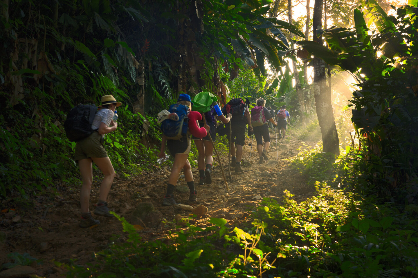
Traveling through the Sierra Nevada de Santa Marta is a unique opportunity to discover the rich biodiversity of the area. There are at least eight clear rivers, such as the Buritaca, Cuices and Don Diego, which rise in the snowy peaks and descend the mountain to flow into the sea. On their way they find a landscape made up of 126 species of plants, including giant trees such as the mastre, caracolí and tagua, the latter popular for its use in handicrafts.
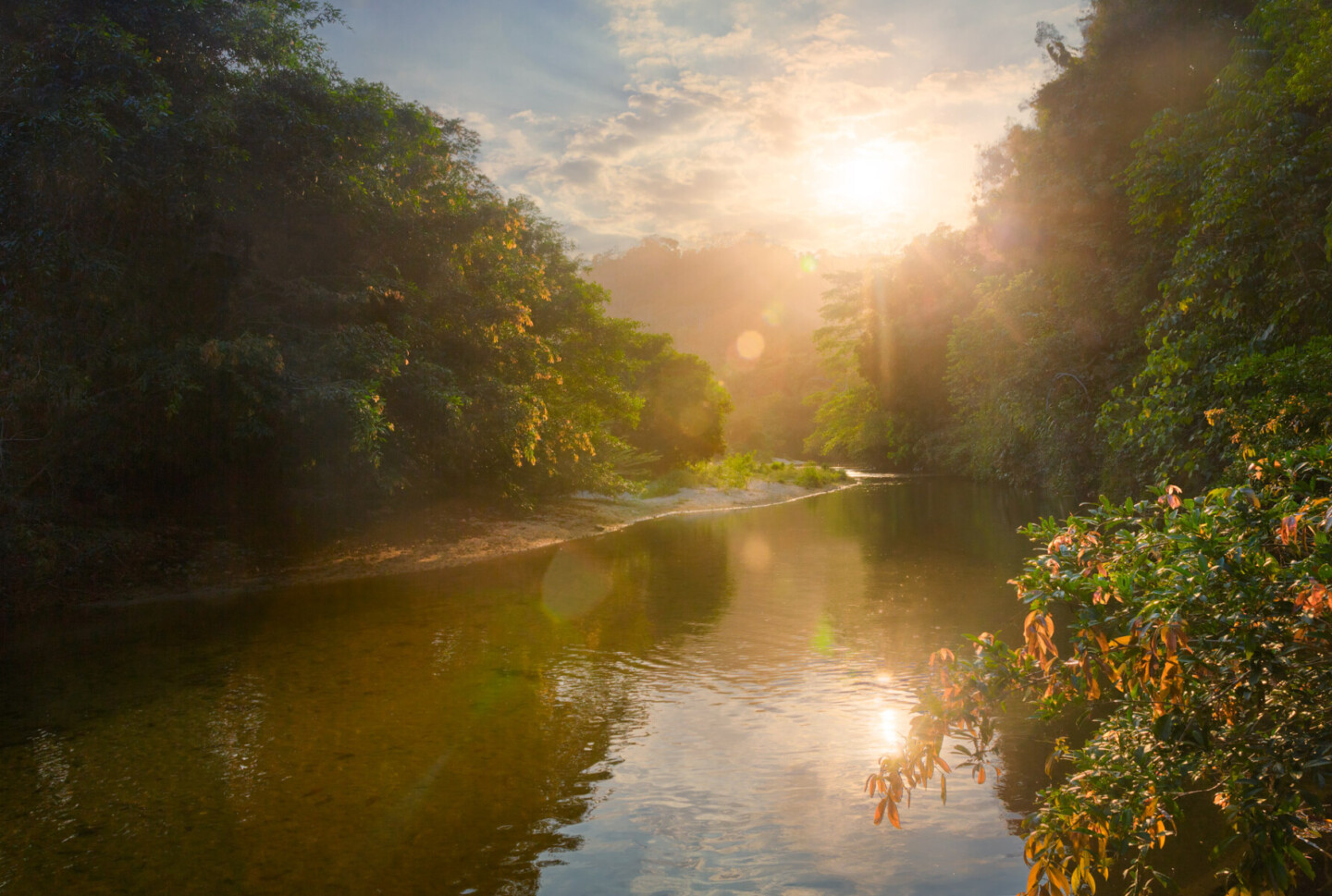
Activities in the Sierra Nevada de Santa Marta
As part of the park’s Management Plan, there are marked trails that lead visitors to some of the park’s most important sites. It is important to remember that access to some areas inhabited by indigenous groups and sacred sites is not allowed. Therefore, this decision should be respected by travelers.
Trail to the Lagoon
It is a three-hour hike of medium difficulty that leads to Nukwlindwe, one of the sacred lagoons of the highlands. During the trip you can observe various species of the sub-Andean forest and from the viewpoints you have a panoramic view of the city of Santa Marta and the mountains: Santa Marta and the snow-capped peaks of Colón and Bolívar.
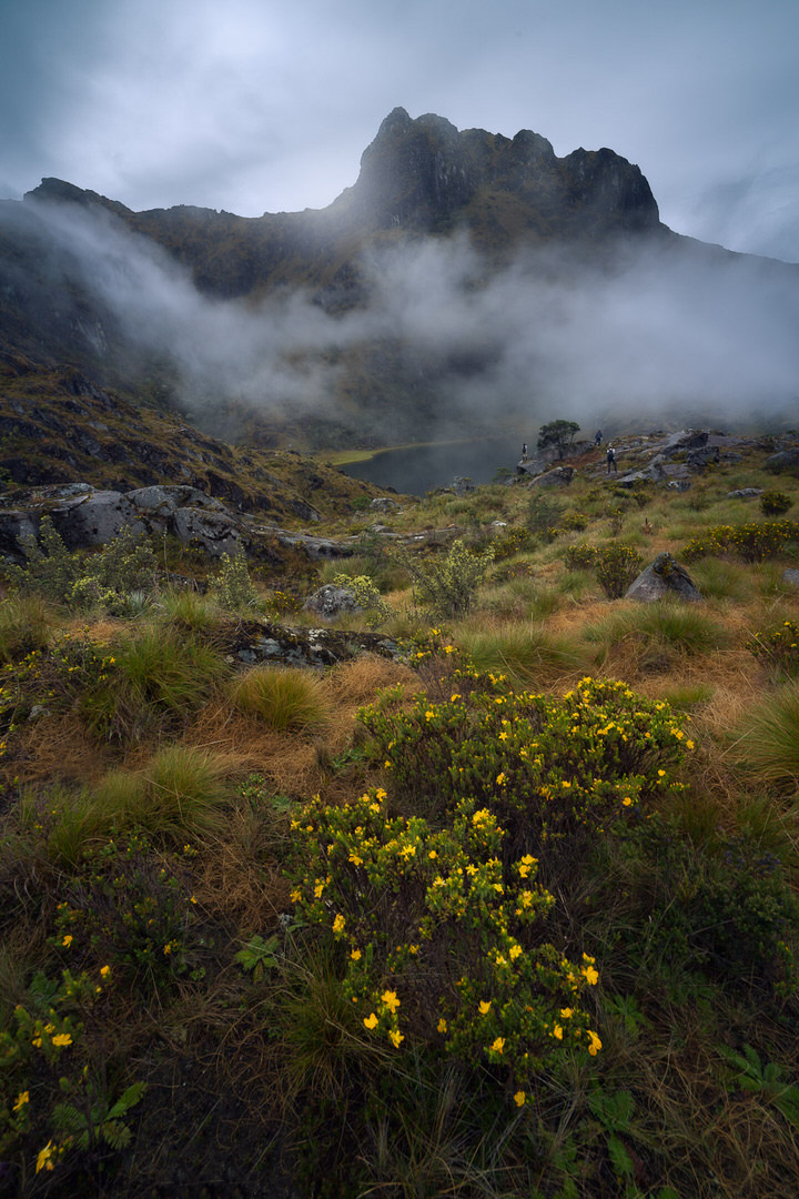
Trail to the San Lorenzo ravine
The traveler can make this journey in an hour and a half, crossing areas with sub-Andean forest vegetation until finally arriving at a fifteen meter high waterfall.
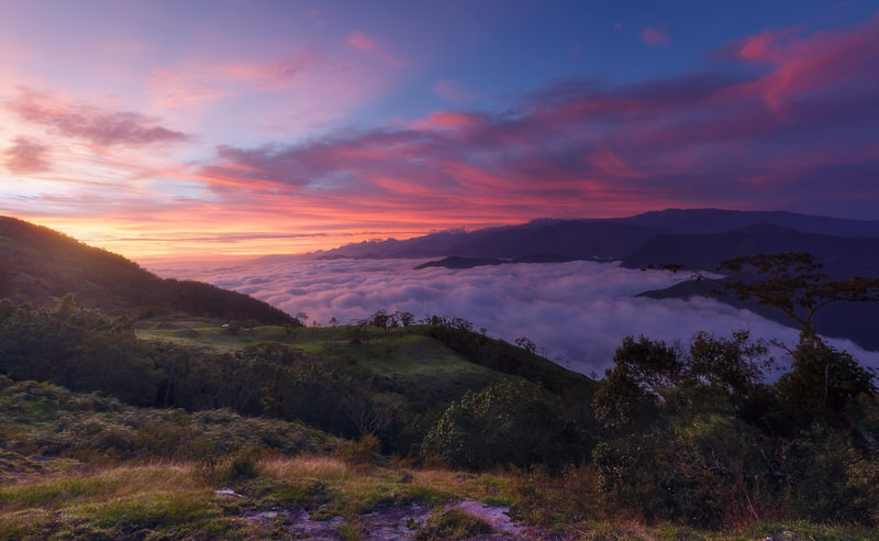
Trail to the waterfall at the source of the Gaira River:
This trail leads to the 30-meter high waterfall that gives rise to the Gaira River. The hike requires approximately five hours and the level of difficulty is high.
Climbing the Colón and Bolívar peaks
With prior authorization from the indigenous people who inhabit this territory and the National Natural Parks Office, visitors have the opportunity to climb to the perpetual snow of the two highest peaks of the Sierra Nevada de Santa Marta. This is an activity recommended only for expert climbers and mountaineers.
How to get around in Sierra Nevada de Santa Marta
Getting around Renting a car
If you want to take a road trip from Santa Marta, and have the freedom to visit Taganga, Minca, Palomino and Tayrona at your own pace, a good idea is to rent a car. Here you can compare the available offers and rent a car at the best price.
Be aware though that road are in a bad state in Sierra Nevada De Santa Marta, and you may need to park the car in the village and then take a 4×4 or a motorbike taxi.
Getting around Renting a Motorcycle
If you would like to visit the area in an adventurous style and go off path, another good idea is to rent a motorcycle. We partner with Adrian who runs Colombian Riders, a motorbike Rental agency
Getting around renting a 4×4 with Driver
If you prefer safety, traveling with an experienced 4×4 driver is essential in the Sierra Nevada de Santa Marta. The roads are often in an incredibly bad state, and in rainy season things get worth. With a private driver, you can drive to Cerro Kennedy or visit remote communities. Here you can contact our partners, we have partnerships with several excellent drivers in the area
Travel Information
How to get to Sierra Nevada de Santa Marta ?
Leaving from the city of Santa Marta, take the road that leads to the department of La Guajira to the San Lorenzo experimental station (distance 42 kms. Travel time approximately 3 h). To reach the station it is necessary to use a four-wheel drive vehicle. Those who wish to climb to other areas of the park, such as Filo Cartagena and Alto de Mira, must take a mule or walk for approximately six hours.
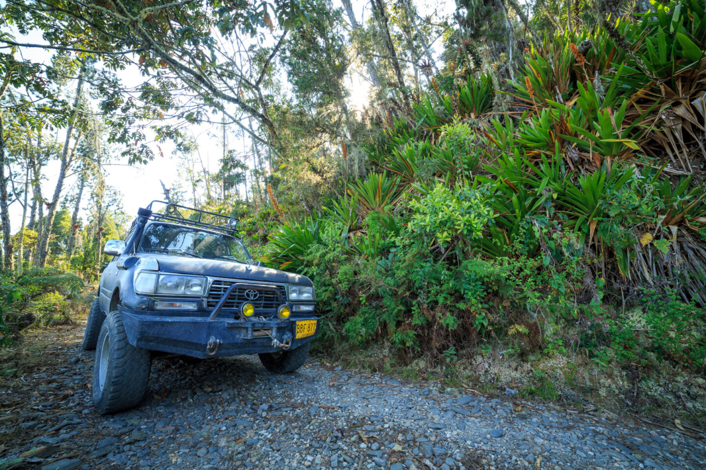
To access the Bolívar and Colón peaks you have to start the trip by road from the city of Valledupar to Pueblo Bello and the Arhuaco village of San Sebastián de Rabago (distance 54 kms. Approximate travel time: 1 h). From there you begin a hike along a trail that leads to the glaciers.
Handcraft of Sierra Nevada De Santa Marta
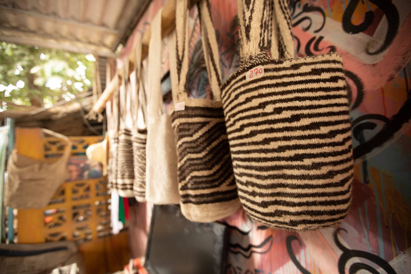
It is suggested to buy handcrafted objects produced by the indigenous communities that inhabit the highlands, such as the tutu or Tayrona backpacks, woven with wool, fique and cotton and symbolizing the creation of life.
Accommodation and Where to Stay
Luxury Resorts for a Pampered Stay
If you’re the kind who likes to adventure by day and soak in a hot tub by night, Sierra Nevada de Santa Marta has got you covered. There are luxury resorts offering all the amenities you could dream of—think spa treatments, fine dining, and breathtaking views from your room. So go ahead, live a little! You deserve it.
Eco-Lodges and Sustainable Options
But what if you want to keep your carbon footprint low while enjoying your stay? Enter eco-lodges. These are not only sustainable but also offer unique experiences like tree-house living or cabins right by the sea. And the best part? They’re often located in the most pristine settings. Could vacationing get any better than this?
Budget-Friendly Hostels for Backpackers
Travelling on a shoestring budget? No worries. There are plenty of hostels that offer a comfortable stay without breaking the bank. These are also great places to meet fellow travelers. Who knows, you might just find your next travel buddy!
Savor the Flavors: Local Cuisine and Where to Eat
Traditional Dishes You Must Try
You can’t say you’ve truly experienced a place until you’ve tasted its food, right? Local dishes like ‘Arepas’ and ‘Cazuela de Mariscos’ are a must-try. Seafood is especially fresh and delicious. Why not take your taste buds on an adventure too?
Street Food Adventures
If you’re more of a grab-and-go kind of person, the street food here will not disappoint. From empanadas to fresh fruit carts, the options are both tasty and cheap. Just a word of caution: the local spice levels might be a bit high for some!
Vegan and Vegetarian Options
Worried about plant-based options? Fear not! Many local restaurants offer vegan and vegetarian dishes that are just as flavorful as their meaty counterparts. So you can stick to your diet while still enjoying local flavors.
Packing Essentials
What to Pack for Different Terrains
From beaches to mountains, the diverse terrains demand a well-thought-out packing list. Swimsuits, trekking boots, light jackets—you’ll need them all. It’s always better to be over-prepared than under, wouldn’t you agree?
Must-Have Gadgets: GPS, Portable Chargers, etc.
In this digital age, some gadgets are just too essential to leave behind. A GPS could be a lifesaver in unknown terrains, and portable chargers will keep your devices juiced up when you’re on the go. Don’t forget a good camera; you’ll be kicking yourself if you can’t capture these amazing experiences.
The Importance of Eco-Friendly and Sustainable Gear
Speaking of gear, try to opt for eco-friendly options. Whether it’s a reusable water bottle or biodegradable soap, every little bit helps in preserving this beautiful destination.
How much does it cost to visit Sierra Nevada de Santa Marta ?
Wondering how much to budget for daily expenses? Accommodation, food, local travel, and activities can all add up. A rough estimate could range from $50 to $200 per day, depending on your travel style.
Itinerary Samples
One Week of Natural Bliss
If you’ve got a week, focus on the must-see spots like Ciudad Perdida, Minca and Tayrona National Park. Trust me, you won’t feel like you’ve missed out.
Two Weeks of Culture and Adventure
With two weeks, you can delve deeper into the local culture, perhaps spending a few days in Minca and Taganga, in addition to the must-visit spots.
Customizable Itineraries for Different Travel Styles
From laid-back beach vacations to adrenaline-pumping adventure trips, there’s an itinerary for every type of traveler. The key is to prioritize based on your interests.
Sierra Nevada de Santa Marta Wiki
The Sierra Nevada de Santa Marta National Park was declared a Biosphere Reserve and World Heritage Site by UNESCO in 1979.
The system that makes up the Sierra Nevada de Santa Marta National Natural Park is seen as a colossus that, in addition to being the highest coastal mountain in the world, covers part of the departments of La Guajira, Magdalena and Cesar. Its image offers the vision of a triangular-shaped mountain peak that reaches 5,777 meters in height, while at its base, just 30 kilometers away, are the coral beaches of the Colombian Caribbean.

Key Data
- Altitude: Between or and 5.775 m.a.s.l.
- Temperature: The park has all climatic ranges, with temperatures ranging from 28SC to -o°C on the snow-capped peaks.
Further Resources
For those of you who love to dive deep, here are some recommended books, documentaries, and apps that will enrich your trip even further. Don’t forget to also check out local tour operators and guides for that extra local flavor.
- La Sierra Nevada de Sainte Marthe – Elysee Reclus
- Aluna – Alan Herrera
- La Sierra Nevdada De Santa Marta – Juan Mayr
- Los Koguis – Tristan Quevilly
- Pictures of Sierra Nevada De Santa Marta
About the Author
An adventurer at heart, the author has explored various corners of the world and believes that the journey is as important as the destination. For more guides to fuel your wanderlust, stay tuned!
Conclusion
So there you have it, your comprehensive guide to Sierra Nevada de Santa Marta. From hidden gems to adrenaline-pumping activities, this place offers an array of experiences that cater to all kinds of travelers. Are you ready to check off this incredible destination from your bucket list?